
Křišťanovice
Křišťanovice | |
|---|---|
Municipality and village | |
 Municipal office | |
 Flag  Coat of arms | |
 Křišťanovice Location in the Czech Republic | |
| Coordinates: 49°51′03″N 17°30′39″E / 49.85083°N 17.51083°E | |
| Country | |
| Region | Moravian-Silesian Region |
| District | Bruntál District |
| Government | |
| • Mayor | Josef Koleňák |
| Area | |
| • Total | 6.26 sq mi (16.21 km2) |
| Elevation | 1,985 ft (605 m) |
| Population (2010) | |
| • Total | 272 |
| • Density | 43/sq mi (17/km2) |
| Time zone | UTC+1 (CET) |
| • Summer (DST) | UTC+2 (CEST) |
| Website | www |
Křišťanovice (German: Christdorf) is a village and municipality in Bruntál District in the Moravian-Silesian Region of the Czech Republic.
Gallery
-
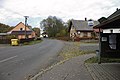
 Road
Road -
 Playground
 -
 Bus stop


Wikimedia Commons has media related to Křišťanovice.
This Moravian-Silesian Region location article is a stub. You can help Wikipedia by expanding it. |