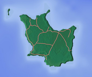
Kaewatine
Kaewatine | |
|---|---|
Village | |
| Coordinates: 21°23′26″S 167°56′8″E / 21.39056°S 167.93556°E | |
| Territory | |
| Province | Loyalty Islands Province |
| Commune | Maré |
| Time zone | UTC+11 |
Kaewatine is a village in the northeast of Maré Island, in the Loyalty Islands of New Caledonia.[1][2] It lies east by road from Thogone and north of Menaku.[3]
References
- ^ "Maré". Direction des Infrastructures de la Topographie et des Transports Terrestres (DITTT). Archived from the original on 25 March 2012. Retrieved 10 June 2011.
{{cite web}}: Unknown parameter|deadurl=ignored (|url-status=suggested) (help) - ^ Fondation Singer-Polignac (1968). Expédition française sur les récifs coralliens de la Nouvelle-Calédonie: organisée sous l'égide de la Fondation Singer-Polignac, 1960-1963. Éditions de la Fondation Singer-Polignac. Retrieved 10 June 2011.
- ^ Google Maps (Map). Google.
{{cite map}}:|access-date=requires|url=(help)

