
Kaltental
This article needs additional citations for verification. (December 2008) |
Kaltental | |
|---|---|
 Coat of arms | |
Location of Kaltental 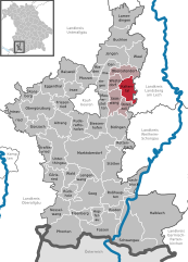 | |
 Kaltental  Kaltental | |
| Coordinates: 47°54′N 10°45′E / 47.900°N 10.750°E | |
| Country | Germany |
| State | Bavaria |
| Admin. region | Schwaben |
| Government | |
| • Mayor | Manfred Hauser |
| Area | |
| • Total | 22.14 km2 (8.55 sq mi) |
| Elevation | 710 m (2,330 ft) |
| Population (2022-12-31)[1] | |
| • Total | 1,785 |
| • Density | 81/km2 (210/sq mi) |
| Time zone | UTC+01:00 (CET) |
| • Summer (DST) | UTC+02:00 (CEST) |
| Postal codes | 87662 |
| Dialling codes | 08345, 08344 |
| Vehicle registration | OAL |
Kaltental is a municipality of Ostallgäu in Bavaria, Germany.
Towns and municipalities in Ostallgäu | ||
|---|---|---|
|  | |
References
- ^ Genesis Online-Datenbank des Bayerischen Landesamtes für Statistik Tabelle 12411-003r Fortschreibung des Bevölkerungsstandes: Gemeinden, Stichtag (Einwohnerzahlen auf Grundlage des Zensus 2011).
| International | |
|---|---|
| National | |
This Ostallgäu location article is a stub. You can help Wikipedia by expanding it. |