Kaluža
Appearance


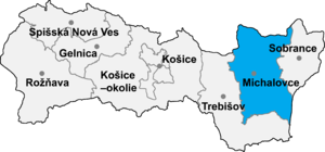
Kaluža (Hungarian: Ungtavas) is a village and municipality in Michalovce District in the Kosice Region of eastern Slovakia.
History
[edit]In historical records the village was first mentioned in 1336. Before the establishment of independent Czechoslovakia in 1918, it was part of Ung County within the Kingdom of Hungary.
Geography
[edit]The village lies at an altitude of 120 metres and covers an area of 9.89 km2 (3.82 sq mi) (2020-06-30/-07-01).[1]
Population
[edit]The municipality has a population of 430 people (2020-12-31).[2]
Genealogical resources
[edit]The records for genealogical research are available at the state archive "Statny Archiv in Presov, Slovakia"
- Roman Catholic church records (births/marriages/deaths): 1742-1935 (parish B)
- Greek Catholic church records (births/marriages/deaths): 1822-1922 (parish B)
See also
[edit]References
[edit]- ^ "Statistic of Slovak places by Dušan Kreheľ – Export". Retrieved 2021-07-05.
- ^ "Statistic of Slovak places by Dušan Kreheľ – Export". Retrieved 2021-07-05.
External links
[edit]Wikimedia Commons has media related to Kaluža (Michalovce District).
- https://web.archive.org/web/20070513023228/http://www.statistics.sk/mosmis/eng/run.html
- Surnames of living people in Kaluza
48°49′N 22°00′E / 48.817°N 22.000°E
