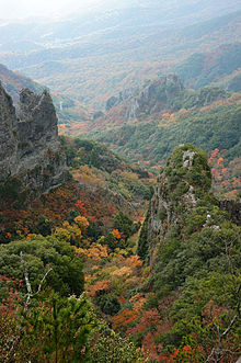
Kankakei
Appearance

The gorge of Kankakei (寒霞渓, Kanka-kei) is a nationally-designated Place of Scenic Beauty on the island of Shōdo-shima, Kagawa Prefecture, Japan.[1] Part of the Setonaikai National Park, the heights rise to 812 m.[2] The area is celebrated for its Japanese maple trees.[3] Volunteers formed a preservation society in 1898 and when, in 1912, expropriation of the area was attempted, a soy sauce magnate stepped in to ensure its preservation.[4] In 1927 Kankakei was selected as one of the 100 Landscapes of Japan.[5]
Landmarks
The Front Side 12
- Tsutenso
- Kountei
- Kinbyobu
- Rosando
- Senjogan
- Gyokujunpo
- Gachoseki
- Soundan
- Kayogaku
- Eboshiiwa
- Joraheki
- Shibocho
-
03. Kinbyobu
-
06. Gyokujunpo
-
08. Soundan
-
10. Eboshiiwa
-
12. Shibocho
The Back Side 8
- Shikaiwa
- Matsutakeiwa
- Taishido
- Noboritake
- Taikigan
- Futamiiwa
- Horagaiwa
- Sekimon
See also
Wikimedia Commons has media related to Kankakei.
References
- ^ "神懸山 (寒霞渓)". Agency for Cultural Affairs. Retrieved 12 February 2012.
- ^ "Introducing places of interest: Setonaikai National Park (Kagawa Prefecture)". Ministry of the Environment. Retrieved 12 February 2012.
- ^ "Shodoshima - Sightseeing". Shōdoshima Town. Retrieved 12 February 2012.
- ^ "Kankakei". Kagawa Prefecture. Retrieved 12 February 2012.
- ^ "日本八景(昭和2年)の選定内容" (PDF). Ministry of the Environment. Retrieved 12 February 2012.


