
Komárov (Beroun District)
Komárov | |
|---|---|
 Míru Square | |
 Flag  Coat of arms | |
 Komárov Location in the Czech Republic | |
| Coordinates: 49°48′24″N 13°51′23″E / 49.80667°N 13.85639°E | |
| Country | |
| Region | Central Bohemian |
| District | Beroun |
| First mentioned | 1263 |
| Area | |
| • Total | 6.16 km2 (2.38 sq mi) |
| Elevation | 398 m (1,306 ft) |
| Population (2023-01-01)[1] | |
| • Total | 2,445 |
| • Density | 400/km2 (1,000/sq mi) |
| Time zone | UTC+1 (CET) |
| • Summer (DST) | UTC+2 (CEST) |
| Postal code | 267 62 |
| Website | www |
Komárov is a market town in Beroun District in the Central Bohemian Region of the Czech Republic. It has about 2,400 inhabitants.
Administrative parts[edit]
The village of Kleštěnice is an administrative part of Komárov.
Geography[edit]
Komárov is located about 22 kilometres (14 mi) southwest of Beroun and 45 km (28 mi) southwest of Prague. It lies on the border between the Brdy Highlands and Hořovice Uplands. The highest point is the hill Hlava at 552 m (1,811 ft) above sea level.
History[edit]
The first written mention of Komárov is from 1263, in a deed of the Ostrov Monastery in Davle. Until 1602, it was owned by the Pešík family. The Pešík family developed the processing of iron ore mined in the area. In 1602, Komárov was bought by Jindřich Otta of Los. After his execution in 1621, Komárov was merged with the Hořovice estate and shared its owners, which lasted until 1902.[2]
In 1917, it became a market town. In 1962, the municipality of Kleštěnice was merged with Komárov.[2]
Demographics[edit]
|
|
| ||||||||||||||||||||||||||||||||||||||||||||||||||||||
| Source: Censuses[3][4] | ||||||||||||||||||||||||||||||||||||||||||||||||||||||||
Sights[edit]
The main landmark of Komárov is the Komárov Castle. It was built on the site of an old Gothic fortress, from which the cellars and the Gothic portal have been preserved. Today the castle houses the Ironworks and Foundry Museum.[5]
The folk architecture in the historic centre of Kleštěnice is well preserved and is protected by law as a village monument zone.[6]
Notable people[edit]
- Kateřina of Komárov (15??–1534), serial killer
Gallery[edit]
-
 Community centre
 -
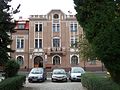 Municipal office
 -
 Local museum

,_%C3%9A%C5%99ad_m%C4%9Bstyse.jpg)

References[edit]
- ^ "Population of Municipalities – 1 January 2023". Czech Statistical Office. 2023-05-23.
- ^ a b "Z historie" (in Czech). Městys Komárov. Retrieved 2022-05-13.
- ^ "Historický lexikon obcí České republiky 1869–2011 – Okres Beroun" (in Czech). Czech Statistical Office. 2015-12-21. pp. 5–6.
- ^ "Population Census 2021: Population by sex". Public Database. Czech Statistical Office. 2021-03-27.
- ^ "Pamětihodnosti" (in Czech). Městys Komárov. Retrieved 2023-03-02.
- ^ "Kleštěnice – vesnická památková zóna" (in Czech). National Heritage Institute. Retrieved 2023-03-02.
External links[edit]
| Authority control databases: National |
|---|