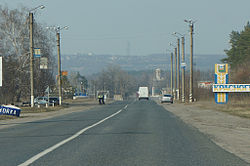
Krasnohrad
Krasnohrad
Красноград | |
|---|---|
 | |
| Coordinates: 49°22′00″N 35°27′00″E / 49.36667°N 35.45000°E | |
| Country Oblast Raion | Ukraine Kharkiv Oblast |
| Area | |
| • Total | 13.55 km2 (5.23 sq mi) |
| Population (1992) | |
| • Total | 27,600 |
| Time zone | UTC+2 (EET) |
| • Summer (DST) | UTC+3 (EET) |
| Website | http://www.krasnograd.com.ua |
Krasnohrad or Krasnograd[1] (Ukrainian: Красноград) is a city in Kharkiv Oblast (province) of Ukraine. In 1784-1922 it was known as Kostyantynohrad or Konstantingrad. It serves as the administrative center of Krasnohrad Raion. Population: 20,914 (2017 est.)[2]
The city of Krasnohrad was founded as a fortress of Bilevsk in 1731-1733, as part of the Ukrainian line defence fortifications, which ran from the Dnieper to the Donets. The fortress was named after the Russian military garrison that was formed in a town of Belyov (near Tula). In 1784 the fortress was renamed Kostyantynohrad, and in 1797 it received city status. In 1922 it was renamed Krasnohrad.
It is located on the Berestova River 101 kilometres (63 mi) to the south of the city of Kharkiv.
References
This article needs additional citations for verification. (August 2011) |
- ^ Also known as Krasnograd fortress (Красноград) (1731-1784), Konstantinograd fortress (Константиноград) (1784-1922), city of Konstantinograd (1922-1943).
- ^ "Чисельність наявного населення України (Actual population of Ukraine)" (in Ukrainian). State Statistics Service of Ukraine. Retrieved 26 August 2017.


