Kurmangazy, Atyrau Region
Kurmangazy
Құрманғазы Qūrmanğazy | |
|---|---|
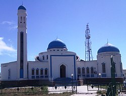
 Mosque in Kurmangazy | |
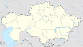
| Coordinates: 46°36′00″N 49°16′00″E / 46.60000°N 49.26667°E | |
| Country | Kazakhstan |
| Region | Atyrau Region |
| Elevation | −23 m (−75.5 ft) |
| Population | |
| • Total | 13 400 |
| • Summer (DST) | +5 |
Kurmangazy or Qūrmanğazy (Kazakh: Құрманғазы [qʊrmɑ́nʁɑzə́]), known before 2018 as Ganyushkin(o) (Kazakh: Ганюшкин; Russian: Ганюшкино), is the administrative center of the Kurmangazy District, Atyrau Region, Kazakhstan. Kurmangazy is situated at 46°38'N, 49°08'E with an elevation of −23 m (−75 ft). Kurmangazy is in the west of Atyrau and close to the north shore of the Caspian Sea and the Kazakhstan–Russia border. It is in the area west of the Ural River and thus in the European part of Kazakhstan. Population: 12,750 (2009 Census results);[1] 12,419 (1999 Census results).[1] It was named after Kazakh composer Qūrmanğazy Sağyrbaev.
Climate
[edit]Kurmangazy has a cold desert climate (Köppen climate classification BWk) with cold winters and warm summers.
| Climate data for Kurmangazy (1991–2020) | |||||||||||||
|---|---|---|---|---|---|---|---|---|---|---|---|---|---|
| Month | Jan | Feb | Mar | Apr | May | Jun | Jul | Aug | Sep | Oct | Nov | Dec | Year |
| Mean daily maximum °C (°F) | −1.5 (29.3) |
0.0 (32.0) |
7.4 (45.3) |
17.1 (62.8) |
24.7 (76.5) |
30.0 (86.0) |
32.5 (90.5) |
31.4 (88.5) |
24.3 (75.7) |
16.1 (61.0) |
6.4 (43.5) |
0.2 (32.4) |
15.7 (60.3) |
| Daily mean °C (°F) | −5.0 (23.0) |
−4.4 (24.1) |
2.4 (36.3) |
11.0 (51.8) |
18.7 (65.7) |
24.0 (75.2) |
26.0 (78.8) |
24.3 (75.7) |
17.5 (63.5) |
10.0 (50.0) |
2.0 (35.6) |
−3.0 (26.6) |
10.3 (50.5) |
| Mean daily minimum °C (°F) | −7.9 (17.8) |
−7.8 (18.0) |
−1.5 (29.3) |
5.7 (42.3) |
13.3 (55.9) |
18.4 (65.1) |
19.8 (67.6) |
17.6 (63.7) |
11.5 (52.7) |
5.2 (41.4) |
−1.4 (29.5) |
−5.8 (21.6) |
5.6 (42.1) |
| Average precipitation mm (inches) | 9.1 (0.36) |
6.3 (0.25) |
11.6 (0.46) |
16.2 (0.64) |
18.2 (0.72) |
16.4 (0.65) |
14.1 (0.56) |
11.7 (0.46) |
13.8 (0.54) |
12.9 (0.51) |
10.4 (0.41) |
9.0 (0.35) |
149.8 (5.90) |
| Average precipitation days (≥ 1.0 mm) | 3.1 | 1.8 | 2.8 | 2.9 | 3.2 | 2.8 | 2.1 | 1.8 | 2.3 | 2.7 | 2.4 | 2.5 | 30.4 |
| Source: NOAA[2] | |||||||||||||
References
[edit]- ^ a b "Население Республики Казахстан" [Population of the Republic of Kazakhstan] (in Russian). Департамент социальной и демографической статистики. Retrieved 8 December 2013.
- ^ "World Meteorological Organization Climate Normals for 1991-2020 — Kurmangazy". National Oceanic and Atmospheric Administration. Retrieved January 2, 2024.
External links
[edit]


