
Kypärämäki
This article has multiple issues. Please help improve it or discuss these issues on the talk page. (Learn how and when to remove these template messages)
|
Kypärämäki | |
|---|---|
District of Jyväskylä | |
 Houses on the street Vuorikatu | |
| Country | |
| Province | Western Finland |
| Region | Central Finland |
| Sub-region | Jyväskylä sub-region |
| City | Jyväskylä |
| Ward | Kypärämäki-Kortepohja |
| Population | |
| • Total | 3,150 |
| Time zone | UTC+2 (EET) |
| • Summer (DST) | UTC+3 (EEST) |
| Postal code | 40630 |
Kypärämäki (literal English translation: helmet hill) is a neighbourhood of Jyväskylä, Finland. It is located at around 3.5 kilometres (2.2 mi) from the city centre south from the sports and recreational area of Laajavuori and east from the lake Köhniönjärvi. There are 3150 inhabitants in Kypärämäki.[1] Kypärämäki includes the areas Kypärärinne, Kypärätie, Köhniö, Köhniönranta and Killeri. Most of the houses in Kypärämäki were built in 1940´s or 1950´s.
Gallery
-
 A house in Kypärämäki
 -
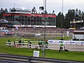 Killeri harness racing track during Rally Finland
 -
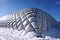 Killeri sports center
 -
 An apartment building in Kypärämäki
 -
 A house in Köhniö


References
- ^ "Kypärämäki–Kortepohja". Jyväskylän seutu – ihmistä varten. 2009. Retrieved 1 April 2012.
External links
![]() Media related to Kypärämäki at Wikimedia Commons
Media related to Kypärämäki at Wikimedia Commons
62°14′17″N 25°41′33″E / 62.23806°N 25.69250°E
This Western Finland location article is a stub. You can help Wikipedia by expanding it. |