Laclede's Landing station
Appearance
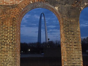
 St. Louis Arch as seen from Laclede's Landing station | ||||||||||||||||
| General information | ||||||||||||||||
| Location | 200 Washington Avenue St. Louis, Missouri 63102 | |||||||||||||||
| Coordinates | 38°37′46″N 90°11′05″W / 38.629519°N 90.184649°W | |||||||||||||||
| Owned by | Bi-State Development Agency | |||||||||||||||
| Operated by | Metro Transit | |||||||||||||||
| Line(s) | Lua error: expandTemplate: template "STML color" does not exist. Lua error: expandTemplate: template "STML color" does not exist. | |||||||||||||||
| Platforms | 1 island platform | |||||||||||||||
| Tracks | 2 | |||||||||||||||
| Construction | ||||||||||||||||
| Structure type | Elevated | |||||||||||||||
| Accessible | Yes | |||||||||||||||
| History | ||||||||||||||||
| Opened | July 31, 1993 | |||||||||||||||
| Passengers | ||||||||||||||||
| 2007 | 1,209 daily | |||||||||||||||
| Services | ||||||||||||||||
| ||||||||||||||||
Laclede's Landing is a St. Louis MetroLink Station. It is located near Laclede's Landing and the Gateway Arch in downtown St. Louis, Missouri. This station is also nearby the headquarters for Metro Transit, the operator of MetroLink and MetroBus. It was one of six MetroLink stations in the Downtown St. Louis Ride Free Zone at lunch time on weekdays prior to the 2009 service reduction.
Laclede's Landing station is the easternmost MetroLink station in Missouri, before crossing the Eads Bridge.
External links
