
Lake City, Arkansas
Lake City, Arkansas | |
|---|---|
 Location in Craighead County and the state of Arkansas | |
| Country | United States |
| State | Arkansas |
| County | Craighead |
| Area | |
| • Total | 2.2 sq mi (5.7 km2) |
| • Land | 2.2 sq mi (5.7 km2) |
| • Water | 0 sq mi (0 km2) |
| Elevation | 226 ft (69 m) |
| Population (2010) | |
| • Total | 2,082 |
| • Density | 889.1/sq mi (343.2/km2) |
| Time zone | UTC-6 (Central (CST)) |
| • Summer (DST) | UTC-5 (CDT) |
| ZIP code | 72437 |
| Area code | 870 |
| FIPS code | 05-37780 |
| GNIS feature ID | 0077429 |
Lake City is a city[1] in Craighead County, Arkansas, United States, along the St. Francis River. The population is 2,082 according to the 2010 census. It is included in the Jonesboro, Arkansas Metropolitan Statistical Area. It serves as a second county seat, serving the Eastern District of Craighead County (Jonesboro serves the Western District).
Notable facts

Lake City has the only lift bridge in the world that has been raised once in its construction. During the construction of St. Francis River Bridge there was an earthquake that made the river unsuitable for boats to pass through.(added by wareark: It wasn't during the construction of the bridge that the earthquake took place.The bridge was constructed in 1934. The earthquake referred to was the New Madrid Earthquake that occurred in 1811 and which changed the course of the Mississippi River and caused the lands surrounding its tributaries to sink in elevation, thus the term Sunken Lands that refers to the Rivervale area near Caraway, Arkansas. The St. Francis river and its tributaries have lots of trees and their water depth is very shallow in some areas. The St. Francis River bridge at Lake City, Arkansas was constructed with the idea in mind that the Corp of Engineers would dredge out the St. Francis River and its tributaries in order that boats and barges could travel from the Mississippi River and open the surrounding area for river commerce much like Memphis, Tennessee. However, that never happened.) In order to construct a four lane highway, a new bridge was constructed in 2002 and the lift bridge was moved to a location just south of the new bridge where it remains as a landmark.
Geography
Lake City is located at 35°49′4″N 90°26′24″W / 35.81778°N 90.44000°W (35.817866, -90.439927)Template:GR.
According to the United States Census Bureau, the town has a total area of 2.2 square miles (5.7 km2), all land.
List Of Highways
Demographics
As of the censusTemplate:GR of 2000, there were 1,956 people, 731 households, and 546 families residing in the town. The population density was 881.9 inhabitants per square mile (340.2/km²). There were 776 housing units at an average density of 349.9 per square mile (135.0/km²). The racial makeup of the town was 98.67% White, 0.05% Black or African American, 0.36% Native American, 0.05% Asian, 0.26% from other races, and 0.61% from two or more races. 1.02% of the population were Hispanic or Latino of any race.
There were 731 households out of which 37.3% had children under the age of 18 living with them, 55.8% were married couples living together, 15.2% had a female householder with no husband present, and 25.3% were non-families. 23.0% of all households were made up of individuals and 12.3% had someone living alone who was 65 years of age or older. The average household size was 2.57 and the average family size was 3.00.
In the town the population was spread out with 27.0% under the age of 18, 8.4% from 18 to 24, 27.8% from 25 to 44, 20.7% from 45 to 64, and 16.1% who were 65 years of age or older. The median age was 35 years. For every 100 females there were 94.4 males. For every 100 females age 18 and over, there were 84.4 males.
The median income for a household in the town was $30,844, and the median income for a family was $33,477. Males had a median income of $27,798 versus $19,205 for females. The per capita income for the town was $14,126. About 11.4% of families and 14.6% of the population were below the poverty line, including 21.1% of those under age 18 and 9.1% of those age 65 or over.
Education
Lake City is part of the Riverside School District, formed as a result of consolidation with the district in nearby Caraway in 1985. The Riverside High School mascot and athletic teams are known as "the Rebels". There are two elementary schools associated with the school: one is located in Lake City and the other in Caraway.
References
- ^ Local.Arkansas.gov - Lake City, retrieved September 3, 2012
Gallery


Municipalities and communities of Craighead County, Arkansas, United States | ||
|---|---|---|
| Cities | 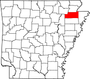 | |
| Towns | ||
| CDP | ||
| Other unincorporated communities | ||
| Ghost town | ||