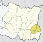
Lakshmipur, Ilam
Laxmipur
लक्ष्मीपुर | |
|---|---|
Village Development Committee | |
 | |
| Country | |
| Zone | Mechi Zone |
| District | Ilam District |
| Population (1991) | |
| • Total | 6,901 |
| Time zone | UTC+5:45 (Nepal Time) |
Laxmipur is a former town and Village Development Committee in Ilam District in the Mechi Zone of eastern Nepal.
Previously when Laxmipur was still a Village Development Committee it consisted total of nine numbered wards. After the political reformation of the country and being declared as official federal democratic republic of Nepal, Laxmipur was merged with Suryodaya Municipality in Feb. 2017, together with some other villages of eastern Ilam. Laxmipur-1,2,4,8 now became Suryodaya-14 and Laxmipur 3-6-7-9 now became Suryodaya-13. Meanwhile Laxmipur's southern and largest ward, ward no. 5 had been added to Mai Municipality as Mai-5.
At the time of the 1991 Nepal census it had a population of 6,901 people living in 1,198 individual households.[1]
References
- ^ "Nepal Census 2001". Nepal's Village Development Committees. Digital Himalaya. Archived from the original on 12 October 2008. Retrieved 17 September 2008.
{{cite web}}: Unknown parameter|deadurl=ignored (|url-status=suggested) (help)

