Larissa Cremaste
38°57′52″N 22°50′20″E / 38.964335°N 22.838823°E

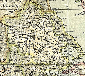
Larissa Cremaste (Template:Lang-grc) was a town of Ancient Thessaly of less importance than Larissa, and was situated in the district of Achaea Phthiotis, at the distance of 20 stadia from the Maliac Gulf, upon a height advancing in front of Mount Othrys.[1] It occupied the side of the hill, and was hence surnamed Cremaste, as "hanging" on the side of Mt. Othrys, to distinguish it from the more celebrated Larissa, situated in a plain. Strabo also describes it as well watered and producing vines. The same writer adds that it was surnamed Pelasgia as well as Cremaste.[2]
From its being situated in the dominions of Achilles, some writers suppose that the Roman poets give this hero the surname of Larissaeus, but this epithet is perhaps used generally for Thessalian. Larissa Cremaste was occupied by Demetrius Poliorcetes in 302 BCE, when he was at war with Cassander.[3] It was taken by Lucius Apustius in the first war between the Romans and Philip V of Macedon, 200 BCE,[4] and again fell into the hands of the Romans in the war with Perseus of Macedon in 171 BCE.[5]
The ruins of the ancient city are situated upon a steep hill, 2 kilometres (1.2 mi) from the modern town of Pelasgia, which was renamed to reflect the ancient surname.[6][7][8] The walls are very conspicuous on the western side of the hill, where several courses of masonry remain. William Gell says that there are the fragments of a Doric temple upon the acropolis, but of these William Martin Leake makes no mention.[9]
References
- ^ Strabo. Geographica. Vol. ix. p.435. Page numbers refer to those of Isaac Casaubon's edition.
- ^ Strabo. Geographica. Vol. ix. p.440. Page numbers refer to those of Isaac Casaubon's edition.
- ^ Diodorus Siculus. Bibliotheca historica (Historical Library). Vol. 20.110.
- ^ Livy. Ab urbe condita Libri [History of Rome]. Vol. 31.46.
- ^ Livy. Ab urbe condita Libri [History of Rome]. Vol. 42.56, 57.
- ^
 Smith, William, ed. (1854–1857). "Larissa". Dictionary of Greek and Roman Geography. London: John Murray.
- ^ Richard Talbert, ed. (2000). Barrington Atlas of the Greek and Roman World. Princeton University Press. p. 55, and directory notes accompanying. ISBN 978-0-691-03169-9.
- ^ Lund University. Digital Atlas of the Roman Empire.
- ^ Gell, Itinerary of Greece, p. 252; Leake, Northern Greece, vol. iv. p. 347.
![]() This article incorporates text from a publication now in the public domain: Smith, William, ed. (1854–1857). "Larissa". Dictionary of Greek and Roman Geography. London: John Murray.
This article incorporates text from a publication now in the public domain: Smith, William, ed. (1854–1857). "Larissa". Dictionary of Greek and Roman Geography. London: John Murray.
