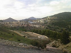
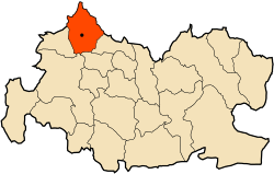
Lazharia
Appearance
Lazharia
Ain Lellou | |
|---|---|
Commune and town | |
 lazharia, 2006 | |
 | |
| Coordinates: 35°36′14″N 1°33′35″E / 35.60389°N 1.55972°E | |
| Country | |
| Province | Tissemsilt Province |
| Population (2008) | |
| • Total | 8,071 |
| Time zone | UTC+1 (CET) |
Lazharia is a town, commune and daïra in Tissemsilt Province in northern Algeria. It is located about 74km west of Tissemsilt and at 45 km of Chlef.
The daïra of Lazharia consists of three communes: Lazharia, Boucaid and Larbaa [1]
The city is located at about 1000m above sea level on the western flanc of the Ouarsenis mountains. The city is populated mainly by berbere tribes: Beni Hendel and Beni Boukhanous.
References
- ^ "Communes of Algeria". Statoids. Retrieved December 12, 2010.


