Le Tampon
Appearance
Le Tampon | |
|---|---|
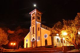
 The church of Le Tampon | |
 | |
| Country | France |
| Overseas region and department | Réunion |
| Arrondissement | Saint-Pierre |
| Intercommunality | Communes du Sud |
| Government | |
| • Mayor (2014-2020) | André Thien Ah Koon |
| Area 1 | 165.43 km2 (63.87 sq mi) |
| Population (2012) | 75,631 |
| • Density | 460/km2 (1,200/sq mi) |
| Time zone | UTC+04:00 |
| INSEE/Postal code | 97422 /97430 |
| Elevation | 287–2,418 m (942–7,933 ft) (avg. 546 m or 1,791 ft) |
| 1 French Land Register data, which excludes lakes, ponds, glaciers > 1 km2 (0.386 sq mi or 247 acres) and river estuaries. | |
Le Tampon (French pronunciation: [lə.tɑ̃.pɔ̃]) is the fourth-largest commune in the French overseas department of Réunion. It is located on the south-central part of the island of Réunion, adjacent to Saint-Pierre.
In the early twentieth century, the town was the base for the murderer and sorcerer Sitarane.[1]
See also
References
- ^ Iledelareunion.net: Sitarane Template:Fr icon
External links
- Official website (in French)
Wikimedia Commons has media related to Le Tampon.


