
Lewisburg, Tennessee
Lewisburg, Tennessee | |
|---|---|
 The town square in Lewisburg | |
| Motto: "The CENTER of Southern Middle Tennessee" | |
 Location of Lewisburg, Tennessee | |
| Coordinates: 35°26′57″N 86°47′35″W / 35.44917°N 86.79306°W | |
| Country | United States |
| State | Tennessee |
| County | Marshall |
| Incorporated | 1837[1] |
| Named for | Meriwhether Lewis[2] |
| Area | |
| • Total | 11.7 sq mi (30.3 km2) |
| • Land | 11.7 sq mi (30.3 km2) |
| • Water | 0.0 sq mi (0.0 km2) |
| Elevation | 738 ft (225 m) |
| Population (2014) | |
| • Total | 11,371 |
| • Density | 950/sq mi (370/km2) |
| Time zone | UTC-6 (Central (CST)) |
| • Summer (DST) | UTC-5 (CDT) |
| ZIP code | 37091 |
| Area code | 931 |
| FIPS code | 47-41860[3] |
| GNIS feature ID | 1291094[4] |
Lewisburg is a city in Marshall County, Tennessee, United States. The population was 11,371 in 2014. It is the county seat of Marshall County.[5] Lewisburg is located in central Tennessee, forty-eight miles south of Nashville and fifty-two miles north of Huntsville, Alabama, along I-65.
Located in the rolling hills of Middle Tennessee, Lewisburg took its name from the explorer Meriwether Lewis. By 1838, the town was supporting a newspaper and a bank. The downtown area is similar to many other small southern towns, with a courthouse in the center of the square surrounded by retail and commercial businesses. Shopping centers are located on the east and west ends of town.
Geography
Lewisburg is located at 35°26′57″N 86°47′35″W / 35.44917°N 86.79306°W (35.449034, -86.793112).[6]
According to the United States Census Bureau, the city has a total area of 11.7 square miles (30 km2), almost all of which is land (0.09% is water).
Demographics
| Census | Pop. | Note | %± |
|---|---|---|---|
| 1870 | 322 | — | |
| 1880 | 460 | 42.9% | |
| 1890 | 631 | 37.2% | |
| 1900 | 1,421 | 125.2% | |
| 1910 | 1,830 | 28.8% | |
| 1920 | 2,711 | 48.1% | |
| 1930 | 3,112 | 14.8% | |
| 1940 | 3,582 | 15.1% | |
| 1950 | 5,164 | 44.2% | |
| 1960 | 6,338 | 22.7% | |
| 1970 | 7,207 | 13.7% | |
| 1980 | 8,760 | 21.5% | |
| 1990 | 9,879 | 12.8% | |
| 2000 | 10,413 | 5.4% | |
| 2010 | 11,100 | 6.6% | |
| 2016 (est.) | 11,600 | [7] | 4.5% |
| Sources:[8][9] | |||
As of the census[3] of 2000, there were 10,413 people, 4,242 households, and 2,740 families residing in the city. The population density was 891.5 people per square mile (344.2/km²). There were 4,584 housing units at an average density of 392.4 per square mile (151.5/km²). The racial makeup of the city was 79.96% White, 15.44% African American, 0.19% Native American, 0.47% Asian, 0.03% Pacific Islander, 2.85% from other races, and 1.06% from two or more races. Hispanic or Latino of any race were 5.15% of the population.
There were 4,242 households out of which 29.2% had children under the age of 18 living with them, 43.4% were married couples living together, 16.6% had a female householder with no husband present, and 35.4% were non-families. 31.0% of all households were made up of individuals and 13.7% had someone living alone who was 65 years of age or older. The average household size was 2.38 and the average family size was 2.94.
In the city, the population was spread out with 24.2% under the age of 18, 10.2% from 18 to 24, 27.3% from 25 to 44, 22.1% from 45 to 64, and 16.3% who were 65 years of age or older. The median age was 37 years. For every 100 females there were 90.0 males. For every 100 females age 18 and over, there were 86.4 males.
The median income for a household in the city was $31,033, and the median income for a family was $38,246. Males had a median income of $30,619 versus $21,765 for females. The per capita income (the average income a person in the city is earning.) was $16,401. About 12.7% of families and 16.1% of the population were below the poverty line, including 20.1% of those under age 18 and 14.2% of those age 65 or over.
History
The area in which Lewisburg and Marshall County is located was first settled by Native Americans. Revolutionary War veterans given land grants by the State of North Carolina for services rendered during the war followed in the 1780s.
Marshall County, named in honor of the young nation's strong first Supreme Court Chief Justice and noted American jurist, John Marshall, was established by an act of the Tennessee General Assembly in 1836. The act which created the county specified that the county seat be named Lewisburg to commemorate the deeds of frontier explorer Meriweather Lewis. Lewisburg was incorporated in 1837, on a site of 50 acres (200,000 m2) donated for civic purpose.
Until 1925, the community served the area principally as a trading and shipping center for its livestock and farm produce.
Marshall County is significant partly because of three Marshall Countians who have served as Governor of Tennessee: Henry Horton, Jim Nance McCord, and Buford Ellington.
Today, Lewisburg/Marshall County is the home of several nationally known industries, and although it has experienced many thousand job losses in recent years, it still maintains a viable work force. It is also the World Headquarters of the Tennessee Walking Horse Breeders' and Exhibitors' Association.
Notable people
- Marcus Haislip - Professional basketball player
- Jason Maxwell - Former professional baseball player
- Dont'a Hightower - Professional football player for the New England Patriots
Media
Radio stations
Television stations
- WAXO Channel 34
References
- ^ Tennessee Blue Book, 2005-2006, pp. 618-625.
- ^ Carroll Van West, "Marshall County," Tennessee Encyclopedia of History and Culture, 2009. Retrieved: 22 January 2013.
- ^ a b "American FactFinder". United States Census Bureau. Retrieved 2008-01-31.
- ^ "US Board on Geographic Names". United States Geological Survey. 2007-10-25. Retrieved 2008-01-31.
- ^ "Find a County". National Association of Counties. Retrieved 2011-06-07.
- ^ "US Gazetteer files: 2010, 2000, and 1990". United States Census Bureau. 2011-02-12. Retrieved 2011-04-23.
- ^ "Population and Housing Unit Estimates". Retrieved June 9, 2017.
- ^ "Census of Population and Housing: Decennial Censuses". United States Census Bureau. Archived from the original on 2006-02-08. Retrieved 2012-03-04.
{{cite web}}: Unknown parameter|deadurl=ignored (|url-status=suggested) (help) - ^ "Incorporated Places and Minor Civil Divisions Datasets: Subcounty Resident Population Estimates: April 1, 2010 to July 1, 2012". Population Estimates. U.S. Census Bureau. Archived from the original on 17 June 2013. Retrieved 11 December 2013.
{{cite web}}: Unknown parameter|deadurl=ignored (|url-status=suggested) (help)
External links
- Lewisburg Local City Guide
- Marshall County Chamber of Commerce
- Goats, Music and More Festival
- TN Farm Products
Municipalities and communities of Marshall County, Tennessee, United States | ||
|---|---|---|
| City | 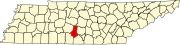 | |
| Towns | ||
| Unincorporated communities | ||
| Ghost town | ||
| Footnotes | ‡This populated place also has portions in an adjacent county or counties | |