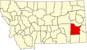
List of lakes of Custer County, Montana
Appearance
(Redirected from List of lakes in Custer County, Montana)
There are at least 23 named lakes and reservoirs in Custer County, Montana.
Lakes
[edit]- Cook Lake, 46°24′18″N 105°51′24″W / 46.40500°N 105.85667°W, el. 2,359 feet (719 m)[1]
- Scanlan Lake, 46°24′13″N 105°51′11″W / 46.40361°N 105.85306°W, el. 2,359 feet (719 m)[2]
Reservoirs
[edit]- Branum Lake, 46°23′14″N 105°51′59″W / 46.38722°N 105.86639°W, el. 2,369 feet (722 m)[3]
- Corny Coulee Reservoir, 46°26′06″N 106°43′05″W / 46.43500°N 106.71806°W, el. 2,743 feet (836 m)[4]
- Corral Creek Reservoir, 46°04′57″N 105°14′17″W / 46.08250°N 105.23806°W, el. 2,844 feet (867 m)[5]
- Dead Cow Reservoir, 46°24′47″N 105°11′42″W / 46.41306°N 105.19500°W, el. 2,762 feet (842 m)[6]
- Hall Reservoir, 46°30′53″N 105°45′23″W / 46.51472°N 105.75639°W, el. 2,362 feet (720 m)[7]
- Hamlick Reservoir, 46°46′01″N 105°52′59″W / 46.76694°N 105.88306°W, el. 2,913 feet (888 m)[8]
- Hay Creek Reservoir, 46°27′53″N 106°42′18″W / 46.46472°N 106.70500°W, el. 2,644 feet (806 m)[9]
- Jones Reservoir, 45°56′02″N 105°07′16″W / 45.93389°N 105.12111°W, el. 2,969 feet (905 m)[10]
- Love Reservoir, 45°53′42″N 105°09′32″W / 45.89500°N 105.15889°W, el. 3,123 feet (952 m)[11]
- McFarland Reservoir, 46°29′57″N 105°31′04″W / 46.49917°N 105.51778°W, el. 2,664 feet (812 m)[12]
- Morgan Creek Reservoir, 46°02′06″N 105°10′13″W / 46.03500°N 105.17028°W, el. 2,802 feet (854 m)[13]
- Noble Reservoir, 46°32′06″N 105°45′47″W / 46.53500°N 105.76306°W, el. 2,379 feet (725 m)[14]
- Noble Reservoir, 46°32′06″N 105°45′50″W / 46.53500°N 105.76389°W, el. 2,379 feet (725 m)[15]
- Physic Creek Reservoir, 46°45′26″N 105°39′18″W / 46.75722°N 105.65500°W, el. 2,559 feet (780 m)[16]
- Pine Hill Reservoir, 46°10′13″N 105°37′47″W / 46.17028°N 105.62972°W, el. 2,664 feet (812 m)[17]
- Pine Hills Reservoir, 46°10′18″N 105°37′56″W / 46.17167°N 105.63222°W, el. 2,723 feet (830 m)[18]
- Shoemaker, 46°31′30″N 105°00′02″W / 46.52500°N 105.00056°W, el. 2,739 feet (835 m)[19]
- Spotted Eagle Lake, 46°23′34″N 105°51′20″W / 46.39278°N 105.85556°W, el. 2,362 feet (720 m)[20]
- Tepee Butte Reservoir, 46°06′14″N 105°01′04″W / 46.10389°N 105.01778°W, el. 2,841 feet (866 m)[21]
- Willie Reservoir, 46°03′19″N 105°10′48″W / 46.05528°N 105.18000°W, el. 2,762 feet (842 m)[22]
- Witcher Reservoir, 45°47′25″N 105°29′39″W / 45.79028°N 105.49417°W, el. 3,123 feet (952 m)[23]
See also
[edit]Notes
[edit]- ^ "Cook Lake". Geographic Names Information System. United States Geological Survey, United States Department of the Interior.
- ^ "Scanlan Lake". Geographic Names Information System. United States Geological Survey, United States Department of the Interior.
- ^ "Branum Lake". Geographic Names Information System. United States Geological Survey, United States Department of the Interior.
- ^ "Corny Coulee Reservoir". Geographic Names Information System. United States Geological Survey, United States Department of the Interior.
- ^ "Corral Creek Reservoir". Geographic Names Information System. United States Geological Survey, United States Department of the Interior.
- ^ "Dead Cow Reservoir". Geographic Names Information System. United States Geological Survey, United States Department of the Interior.
- ^ "Hall Reservoir". Geographic Names Information System. United States Geological Survey, United States Department of the Interior.
- ^ "Hamlick Reservoir". Geographic Names Information System. United States Geological Survey, United States Department of the Interior.
- ^ "Hay Creek Reservoir". Geographic Names Information System. United States Geological Survey, United States Department of the Interior.
- ^ "Jones Reservoir". Geographic Names Information System. United States Geological Survey, United States Department of the Interior.
- ^ "Love Reservoir". Geographic Names Information System. United States Geological Survey, United States Department of the Interior.
- ^ "McFarland Reservoir". Geographic Names Information System. United States Geological Survey, United States Department of the Interior.
- ^ "Morgan Creek Reservoir". Geographic Names Information System. United States Geological Survey, United States Department of the Interior.
- ^ "Noble Reservoir". Geographic Names Information System. United States Geological Survey, United States Department of the Interior.
- ^ "Noble Reservoir". Geographic Names Information System. United States Geological Survey, United States Department of the Interior.
- ^ "Physic Creek Reservoir". Geographic Names Information System. United States Geological Survey, United States Department of the Interior.
- ^ "Pine Hill Reservoir". Geographic Names Information System. United States Geological Survey, United States Department of the Interior.
- ^ "Pine Hills Reservoir". Geographic Names Information System. United States Geological Survey, United States Department of the Interior.
- ^ "Shoemaker". Geographic Names Information System. United States Geological Survey, United States Department of the Interior.
- ^ "Spotted Eagle Lake". Geographic Names Information System. United States Geological Survey, United States Department of the Interior.
- ^ "Tepee Butte Reservoir". Geographic Names Information System. United States Geological Survey, United States Department of the Interior.
- ^ "Willie Reservoir". Geographic Names Information System. United States Geological Survey, United States Department of the Interior.
- ^ "Witcher Reservoir". Geographic Names Information System. United States Geological Survey, United States Department of the Interior.

