List of lakes of Yell County, Arkansas
Appearance
(Redirected from List of lakes in Yell County, Arkansas)
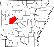
There are at least 26 named lakes and reservoirs in Yell County, Arkansas.

Lakes
[edit]- Buckman Lake, 35°04′33″N 093°28′14″W / 35.07583°N 93.47056°W, el. 338 feet (103 m) [1]
- Cowger Lake, 35°03′09″N 093°24′36″W / 35.05250°N 93.41000°W, el. 325 feet (99 m) [2]
- Gibson Lake, 35°07′48″N 093°07′34″W / 35.13000°N 93.12611°W, el. 295 feet (90 m) [3]
- Horseshoe Lake, 35°03′38″N 093°27′04″W / 35.06056°N 93.45111°W, el. 325 feet (99 m) [4]
- Keeland Lake, 35°02′48″N 093°12′15″W / 35.04667°N 93.20417°W, el. 292 feet (89 m) [5]
- Luther Lake, 35°07′51″N 093°05′28″W / 35.13083°N 93.09111°W, el. 285 feet (87 m) [6]
- Mason Lake, 35°03′56″N 093°27′23″W / 35.06556°N 93.45639°W, el. 325 feet (99 m) [7]
- Open Slough, 35°08′50″N 093°07′15″W / 35.14722°N 93.12083°W, el. 302 feet (92 m) [8]
- Peeler Lake, 35°04′09″N 093°19′51″W / 35.06917°N 93.33083°W, el. 312 feet (95 m) [9]
- Peter George Lake, 35°06′14″N 093°18′14″W / 35.10389°N 93.30389°W, el. 322 feet (98 m) [10]
- Rose Lake, 35°03′45″N 093°05′12″W / 35.06250°N 93.08667°W, el. 299 feet (91 m) [11]
- Surrounded Ridges Lake, 35°05′20″N 093°18′21″W / 35.08889°N 93.30583°W, el. 308 feet (94 m) [12]
Reservoirs
[edit]- Bailey Branch Lake, 35°02′12″N 093°26′57″W / 35.03667°N 93.44917°W, el. 344 feet (105 m) [13]
- Blue Mountain Lake, 35°05′59″N 093°42′02″W / 35.09972°N 93.70056°W, el. 384 feet (117 m) [14]
- Bogs Lake, 35°08′01″N 093°17′47″W / 35.13361°N 93.29639°W, el. 338 feet (103 m) [15]
- Cedar-Piney Lake, 35°06′50″N 093°29′11″W / 35.11389°N 93.48639°W, el. 387 feet (118 m) [16]
- Chambers Lake, 35°02′37″N 093°27′49″W / 35.04361°N 93.46361°W, el. 427 feet (130 m) [17]
- Harris Fish Farm Reservoir, 35°06′07″N 093°21′22″W / 35.10194°N 93.35611°W, el. 351 feet (107 m) [18]
- Kingfisher Lake, 35°05′44″N 093°06′20″W / 35.09556°N 93.10556°W, el. 315 feet (96 m) [19]
- Lake Ola, 35°01′54″N 092°14′01″W / 35.03167°N 92.23361°W, el. 361 feet (110 m) [20]
- Lake Ola-dale, 35°01′48″N 093°14′10″W / 35.03000°N 93.23611°W, el. 390 feet (120 m) [21]
- Mockingbird Hill Lake, 35°06′27″N 093°13′05″W / 35.10750°N 93.21806°W, el. 354 feet (108 m) [22]
- Nimrod Lake, 34°57′03″N 093°14′37″W / 34.95083°N 93.24361°W, el. 341 feet (104 m) [23]
- Pullen Pond, 35°05′12″N 093°08′06″W / 35.08667°N 93.13500°W, el. 302 feet (92 m) [24]
- Schoonover Lake, 35°05′15″N 093°12′12″W / 35.08750°N 93.20333°W, el. 348 feet (106 m) [25]
- Spring Lake, 35°09′14″N 093°25′39″W / 35.15389°N 93.42750°W, el. 512 feet (156 m) [26]
See also
[edit]Notes
[edit]- ^ "Buckman Lake". Geographic Names Information System. United States Geological Survey, United States Department of the Interior.
- ^ "Cowger Lake". Geographic Names Information System. United States Geological Survey, United States Department of the Interior.
- ^ "Gibson Lake". Geographic Names Information System. United States Geological Survey, United States Department of the Interior.
- ^ "Horseshoe Lake". Geographic Names Information System. United States Geological Survey, United States Department of the Interior.
- ^ "Keeland Lake". Geographic Names Information System. United States Geological Survey, United States Department of the Interior.
- ^ "Luther Lake". Geographic Names Information System. United States Geological Survey, United States Department of the Interior.
- ^ "Mason Lake". Geographic Names Information System. United States Geological Survey, United States Department of the Interior.
- ^ "Open Slough". Geographic Names Information System. United States Geological Survey, United States Department of the Interior.
- ^ "Peeler Lake". Geographic Names Information System. United States Geological Survey, United States Department of the Interior.
- ^ "Peter George Lake". Geographic Names Information System. United States Geological Survey, United States Department of the Interior.
- ^ "Rose Lake". Geographic Names Information System. United States Geological Survey, United States Department of the Interior.
- ^ "Surrounded Ridges Lake". Geographic Names Information System. United States Geological Survey, United States Department of the Interior.
- ^ "Bailey Branch Lake". Geographic Names Information System. United States Geological Survey, United States Department of the Interior.
- ^ "Blue Mountain Lake". Geographic Names Information System. United States Geological Survey, United States Department of the Interior.
- ^ "Bogs Lake". Geographic Names Information System. United States Geological Survey, United States Department of the Interior.
- ^ "Cedar-Piney Lake". Geographic Names Information System. United States Geological Survey, United States Department of the Interior.
- ^ "Chambers Lake". Geographic Names Information System. United States Geological Survey, United States Department of the Interior.
- ^ "Harris Fish Farm Reservoir". Geographic Names Information System. United States Geological Survey, United States Department of the Interior.
- ^ "Kingfisher Lake". Geographic Names Information System. United States Geological Survey, United States Department of the Interior.
- ^ "Lake Ola". Geographic Names Information System. United States Geological Survey, United States Department of the Interior.
- ^ "Lake Ola-dale". Geographic Names Information System. United States Geological Survey, United States Department of the Interior.
- ^ "Mockingbird Hill Lake". Geographic Names Information System. United States Geological Survey, United States Department of the Interior.
- ^ "Nimrod Lake". Geographic Names Information System. United States Geological Survey, United States Department of the Interior.
- ^ "Pullen Pond". Geographic Names Information System. United States Geological Survey, United States Department of the Interior.
- ^ "Schoonover Lake". Geographic Names Information System. United States Geological Survey, United States Department of the Interior.
- ^ "Spring Lake". Geographic Names Information System. United States Geological Survey, United States Department of the Interior.

