From Wikipedia, the free encyclopedia
This is a list of listed buildings in the parish of Edzell in Angus, Scotland .
Name
Location
Date Listed
Grid Ref. [ note 1] Geo-coordinates
Notes
LB Number [ note 2]
Image
Old Churchyard, Edzell, Lyndsay Burial Vault
56°48′29″N 2°41′07″W / 56.807925°N 2.68514°W / 56.807925; -2.68514 (Old Churchyard, Edzell, Lyndsay Burial Vault ) Category B
11256
Upload another image See more images
Auchmull Bridge Over Burn Of Auchmull
56°51′34″N 2°40′59″W / 56.859503°N 2.683098°W / 56.859503; -2.683098 (Auchmull Bridge Over Burn Of Auchmull ) Category B
11267
Upload Photo
Gannochy Bridge Over River North Esk
56°49′40″N 2°39′24″W / 56.827761°N 2.656729°W / 56.827761; -2.656729 (Gannochy Bridge Over River North Esk ) Category B
11259
Upload Photo
Doulie Cottage
56°50′40″N 2°40′23″W / 56.844564°N 2.673023°W / 56.844564; -2.673023 (Doulie Cottage ) Category C(S)
11266
Upload Photo
Dalhastnie Bridge Over River North Esk
56°53′50″N 2°45′11″W / 56.897129°N 2.753061°W / 56.897129; -2.753061 (Dalhastnie Bridge Over River North Esk ) Category C(S)
13745
Upload Photo
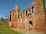
Edzell Castle
56°48′42″N 2°40′55″W / 56.811617°N 2.681964°W / 56.811617; -2.681964 (Edzell Castle ) Category A
11257
Upload another image
Edzell Castle Custodian's House
56°48′43″N 2°40′48″W / 56.811925°N 2.679873°W / 56.811925; -2.679873 (Edzell Castle Custodian's House ) Category B
11258
Upload another image
Dalhousie Lodge, Edzell
56°48′07″N 2°39′25″W / 56.802022°N 2.656851°W / 56.802022; -2.656851 (Dalhousie Lodge, Edzell ) Category C(S)
11263
Upload Photo
Doulie Tower
56°50′37″N 2°40′20″W / 56.843696°N 2.672319°W / 56.843696; -2.672319 (Doulie Tower ) Category B
11265
Upload Photo
95, 97 High Street
56°48′43″N 2°39′26″W / 56.81184°N 2.657138°W / 56.81184; -2.657138 (95, 97 High Street ) Category C(S)
11251
Upload Photo
Edzell Castle, Mains Of Edzell, Doocot
56°48′41″N 2°40′31″W / 56.811393°N 2.675294°W / 56.811393; -2.675294 (Edzell Castle, Mains Of Edzell, Doocot ) Category A
12385
Upload another image
Millden Bridge Over Burn Of Turret
56°53′57″N 2°45′21″W / 56.899296°N 2.755699°W / 56.899296; -2.755699 (Millden Bridge Over Burn Of Turret ) Category C(S)
11247
Upload Photo
North Lodge, Church Street
56°48′42″N 2°39′30″W / 56.811645°N 2.658363°W / 56.811645; -2.658363 (North Lodge, Church Street ) Category B
11250
Upload another image
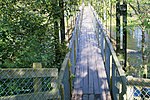
Edzell Suspension Bridge Over River North Esk
56°48′40″N 2°39′11″W / 56.811088°N 2.653177°W / 56.811088; -2.653177 (Edzell Suspension Bridge Over River North Esk ) Category C(S)
11253
Upload another image See more images
Edzell J.S. School Hall (Former U.F. Church)
56°48′42″N 2°39′28″W / 56.811774°N 2.657808°W / 56.811774; -2.657808 (Edzell J.S. School Hall (Former U.F. Church) ) Category B
11254
Upload Photo
Millden Lodge
56°53′55″N 2°45′16″W / 56.898638°N 2.754569°W / 56.898638; -2.754569 (Millden Lodge ) Category B
11268
Upload Photo
Edzell & Lethnot Parish Church With Walls And Gates (Originally Edzell Parish)
56°48′46″N 2°39′33″W / 56.812692°N 2.659053°W / 56.812692; -2.659053 (Edzell & Lethnot Parish Church With Walls And Gates (Originally Edzell Parish) ) Category B
11249
Upload another image See more images
Dalhousie Memorial Arch, Edzell
56°48′20″N 2°39′12″W / 56.80558°N 2.653327°W / 56.80558; -2.653327 (Dalhousie Memorial Arch, Edzell ) Category B
11262
Upload another image See more images
Bridge Of Margie Over Burn Of Margie
56°49′12″N 2°42′39″W / 56.819955°N 2.710736°W / 56.819955; -2.710736 (Bridge Of Margie Over Burn Of Margie ) Category C(S)
11264
Upload Photo
5 High Street
56°48′30″N 2°39′18″W / 56.808213°N 2.655011°W / 56.808213; -2.655011 (5 High Street ) Category C(S)
11252
Upload Photo
Old Churchyard, Edzell
56°48′29″N 2°41′06″W / 56.808034°N 2.684945°W / 56.808034; -2.684945 (Old Churchyard, Edzell ) Category B
11255
Upload another image See more images
Loups Suspension Bridge Over River North Esk
56°50′06″N 2°39′58″W / 56.835133°N 2.665986°W / 56.835133; -2.665986 (Loups Suspension Bridge Over River North Esk ) Category B
11260
Upload another image
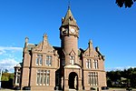
Edzell, Inglis Memorial Hall Including Boundary Wall
56°48′26″N 2°39′13″W / 56.807259°N 2.653651°W / 56.807259; -2.653651 (Edzell, Inglis Memorial Hall Including Boundary Wall ) Category A
11261
Upload another image
Gannochy Pumping Station
56°49′32″N 2°40′07″W / 56.82556°N 2.668684°W / 56.82556; -2.668684 (Gannochy Pumping Station ) Category B
49911
Upload Photo
The scheme for classifying buildings in Scotland is:
Category A : "buildings of national or international importance, either architectural or historic; or fine, little-altered examples of some particular period, style or building type."[ 1] Category B : "buildings of regional or more than local importance; or major examples of some particular period, style or building type, which may have been altered."[ 1] Category C : "buildings of local importance; lesser examples of any period, style, or building type, as originally constructed or moderately altered; and simple traditional buildings which group well with other listed buildings."[ 1] In March 2016 there were 47,288 listed buildings in Scotland. Of these, 8% were Category A, and 50% were Category B, with the remaining 42% being Category C.[ 2]
56°32′09″N 2°59′20″W
Category B
17801[ 3]


