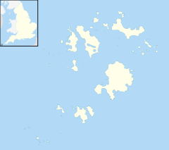
Longstone, Isles of Scilly
Appearance
| Longstone | |
|---|---|
 An old ship's anchor buried by the side of the lane in Longstone | |
Location within Isles of Scilly | |
| Civil parish |
|
| Unitary authority | |
| Ceremonial county | |
| Region | |
| Country | England |
| Sovereign state | United Kingdom |
| Post town | ISLES OF SCILLY |
| Postcode district | TR21 |
| Dialling code | 01720 |
| Police | Devon and Cornwall |
| Fire | Isles of Scilly |
| Ambulance | South Western |
| UK Parliament | |
Longstone is small settlement on the island of St Mary's, the largest of the Isles of Scilly, England. Nearby is Holy Vale and Rocky Hill. Longstone is located inland, at the approximate geographic centre of the island.[1][2]
In Longstone is Carreg Dhu Garden, a publicly-accessible 1.5 acres (0.61 ha) garden set in a former quarry, maintained by volunteers.[2] Until recently there was also a Heritage Centre at Longstone, but this is currently (as of 2015) closed and is proposed to become bunkhouse accommodation for educational institutions (e.g. schools, universities).
References
- ^ Ordnance Survey: Landranger map sheet 203 Land's End ISBN 978-0-319-23148-7
- ^ a b Scilly Online Carreg Dhu Garden


