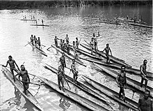
Lorentz River
Appearance

The Lorentz River (also Unir or Undir) is located in Western New Guinea, Indonesia. It originates in the central east-west mountain range of New Guinea, and flows southwards into the Arafura Sea at Flamingo Bay. During the first two Dutch expeditions to Southern New Guinea (1907–10) it was called Northern River. In 1910 it was renamed after the Dutch explorer Hendrikus Albertus Lorentz. After it became part of Indonesia, it was renamed to Unir, as in the language of the local Asmat people, while the Lorentz name is still in use.
External links
- Map and pictures of Lorentz River from The Papua Insects Foundation.
5°32′32″S 138°02′36″E / 5.54222°S 138.04333°E
