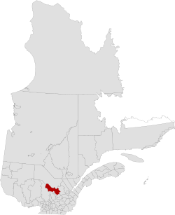
Mékinac Regional County Municipality
Mékinac | |
|---|---|
 | |
| Country | |
| Province | |
| Region | Mauricie |
| Effective | January 1, 1982 |
| County seat | Saint-Tite |
| Municipalities | |
| Government | |
| • Type | Prefecture |
| • Prefect | Alain Vallée |
| Area | |
| • Total | 5,554.90 km2 (2,144.76 sq mi) |
| • Land | 5,226.08 km2 (2,017.80 sq mi) |
| Population (2011)[2] | |
| • Total | 12,924 |
| • Density | 2.5/km2 (6/sq mi) |
| • Pop 2006-2011 | |
| • Dwellings | 8,237 |
| Time zone | UTC−5 (EST) |
| • Summer (DST) | UTC−4 (EDT) |
| Area code(s) | 418 and 581 |
| Website | www |
Mékinac is a regional county municipality (MRC) in the administrative region of Mauricie, in the province of Quebec, Canada. Its seat is Saint-Tite. It is composed of 10 municipalities and 4 unorganized territories.
Toponomy
According to the Commission de Toponymie du Québec, the name Mekinac, pronounced /mekinak/ in French, has an Algonquin origin, that means "turtle". Native Americans often designated places based on the name of the animal kingdom. Once known, the toponym allowed to refer to the same place in conversations. Mikinak designation was assigned to a nearby mountain. A second thesis refers to the abundance of turtles in the area.[1] However, the name is also similar to the historical Algonquin word mekanâc, pronounced /me:kana:ʃ/, meaning "small path". The toponym Mekinac was assigned to the Mékinac River, Mékinac Lake, at Mékinac (township), in the ex-municipality of Saint-Joseph-de-Mékinac, Quebec, and town of Saint-Roch-de-Mékinac.
History
Mékinac MRC was created on January 1, 1982.
Subdivisions
There are 14 subdivisions within the RCM:[1]
|
|
|
|
|
Municipalities of MRC Mékinac
| Municipality | Status | Surface km2 |
Population (2011)[4] | Density hab./km2 |
|---|---|---|---|---|
| Grandes-Piles | Municipality of village | 120.53 | 361 | 3.0 |
| Hérouxville | Municipality of parish | 53.04 | 1,340 | 25.3 |
| Lac-aux-Sables | Municipality of parish | 270.38 | 1,373 | 5.1 |
| Lac-Boulé | Unorganized area (Canada) | 22.96 | 0 | 0.0 |
| Lac-Masketsi | Unorganized area (Canada) | 213.29 | 0 | 0.0 |
| Lac-Normand | Unorganized area (Canada) | 2,038.09 | 5 | 0.0 |
| Notre-Dame-de-Montauban | Municipality | 165.37 | 747 | 4.5 |
| Rivière-de-la-Savane | Unorganized area (Canada) | 1,088.02 | 0 | 0.0 |
| Saint-Adelphe | Municipality of parish | 137.45 | 952 | 6.9 |
| Saint-Roch-de-Mékinac | Municipality of parish | 144.59 | 438 | 3.0 |
| Saint-Séverin | Municipality of parish | 62.28 | 860 | 13.8 |
| Saint-Tite | City | 92.53 | 3,880 | 41.9 |
| Sainte-Thècle | Municipality | 213.46 | 2,478 | 11.6 |
| Trois-Rives | Municipality | 603.94 | 490 | 0.8 |
| Total | 5,226.08 | 12,919 | 2.47 |
Between 2006 and 2011, the population grew by 2.0%. The MRC has 8,237 private dwellings whose 6,096 private dwellings are occupied by usual residents. The median age of the population is 52.6 years old. Statistics Canada reports that in 2011, 88.5% of the population was aged 15 and over, meanings 11,430 individuals (including 5700 men and 5730 women), divided into 3,940 private households. This census indicates that 2,070 people lived alone. Of this population, 1,880 individuals have mastered both French and English, or 14.6%.[5]
Transportation
Access Routes
Highways and numbered routes that run through the municipality, including external routes that start or finish at the county border:[6]
|
|
See also
- List of regional county municipalities and equivalent territories in Quebec
- Batiscanie, Quebec
- Batiscan River
- Rivière des Envies
- Little Mékinac North River
- Rivière du milieu (Mékinac)
- Rivière aux eaux mortes (Mékinac)
- Tawachiche River
- Tawachiche West River
- Pierre-Paul River
- Saint-Maurice River
- Mékinac River
- Mékinac Lake
- Missionary Lake
- Lake Jesuit
- Lake Traverse (Mékinac)
- Regional County Municipality
- Irénée-Marie Ecological Reserve
- Grande-Anse (Mékinac) (hamlet)
References
- ^ a b c d Ministère des Affaires municipale et des Régions du Québec. "Mékinac - Résertoire des municipalités". Retrieved 2008-01-11. Cite error: The named reference "mamrot" was defined multiple times with different content (see the help page).
- ^ a b "Mékinac Regional County Municipality (Code 2435) Census Profile". 2011 census. Government of Canada - Statistics Canada.
- ^ "Banque de noms de lieux du Québec: Reference number 141055". toponymie.gouv.qc.ca (in French). Commission de toponymie du Québec.
- ^ Recensement de 2011 du Canada
- ^ [Link Canada - 2011 Census Profile]
- ^ Official Transport Quebec Road Map
