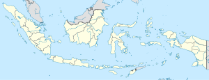
Madiun River
The Madiun River (Template:Lang-id or Kali Madiun) is a river in East Java, Indonesia, about 500 km to the east of the capital Jakarta.[1] It is the largest tributary of the Solo River.[2] Its name indicates that it passes through the major city of Madiun, East Java, Indonesia.[3] This river starts as a number of smaller tributaries converging near the city of Ponorogo, in particular the Kali Slahung, Kali Keyang and Kali Sungkur.[4] It eventually converges with the Solo River near the city of Ngawi.[5]
Historical note
In 1825, the Dutch East Indies soldiers built a fortress near the convergence of the Madiun and Solo rivers, to fight a local rebellion led by Diponegoro. The fortress was named Fort Van Den Bosch;[2] known locally as Benteng Pendem Ngawi.[6]
Geography
The river flows entirely within the Province of East Java, passing through Ponorogo Regency, Madiun Regency, City of Madiun, Magetan Regency and Ngawi Regency, with savanna climate.[7] The annual average temperature in the area is 26°C. The warmest month is October, when the average temperature is around 30°C, and the coldest is January, at 24°C.[8] The wettest month is March, with an average of 546 mm rainfall, and the driest is September, with 21 mm rainfall.[9]
For ages the Madiun River has notoriously caused flooding during the rainy season.[10] Every year the seasonal deluge submerges many fields and houses along the river banks, including some districts in Ponorogo Regency in the upper reaches[4] and in the Ngawi Regency in the lower reaches.[11][12][13] The high debit of water overflows to the Solo River, adding to the regular flooding in Bojonegoro Regency.[14] During the dry season, the river becomes a touristic place for fishing, or a place to mine sands for local people.[15]
Tourism
- Wana Wisata Grape at Catur river (Grape river).[16]
See also
Reference
- ^ Rand McNally, The New International Atlas, 1993.
- ^ a b Kali Madiun at Geonames.org (cc-by); Mail updated 2012-01-17; Database dump downloaded 2015-11-27
- ^ Kali Madiun: Indonesia - National Geospatial-Intelligence Agency, Bethesda, MD, USA.
- ^ a b Tamtomo, Muslimin (2014) Spatial Planning for Flood Management in Ponorogo Retention Area. Graduate School Gadjah Mada University, Yogyakarta.
- ^ Prawirodiharjo, S (1987). Alam Sekitar Lingkungan Hidup Manusia. PT Balai Pustaka (Persero). p. 13.
- ^ Template:Id Ekspedisi bengawan Solo: laporan jurnalistik Kompas : kehancuran peradaban sungai besar. Penerbit Buku Kompas. 2008. ISBN 9789797093907. p. 45
- ^ Peel, M C; Finlayson, B L; McMahon, T A (2007). "Updated world map of the Köppen-Geiger climate classification". Hydrology and Earth System Sciences. 11. doi:10.5194/hess-11-1633-2007.
{{cite journal}}: Cite has empty unknown parameter:|1=(help)CS1 maint: unflagged free DOI (link) - ^ "NASA Earth Observations Data Set Index". NASA. 30 January 2016.
- ^ "NASA Earth Observations: Rainfall (1 month - TRMM)". NASA/Tropical Rainfall Monitoring Mission. 30 January 2016.
- ^ Template:De icon Junghuhn, Franz Wilhelm; Hasskarl, Justus Karl (1854). Java, seine Gestalt, Pflanzendecke und innere Bauart, Volume 2. Arnold. pp. 331, 363.
- ^ Template:Id Bengawan Madiun Meluap - Pojokpitu, Ngawi. 18 Januari 2017.
- ^ Template:Id Dua Kecamatan di Ngawi Terendam Luapan Air Bengawan Madiun - Bangsa Online, 02 Maret 2017.
- ^ Template:Id Sungai Bengawan Madiun Meluap, Jalan Kwadungan-Kendung Terputus - Kompas, 24 April 2017.
- ^ Template:Id Hilir Jatim Masuk Siaga Banjir Bengawan Solo - Madiun Raya, 16 Februari 2017.
- ^ Template:Id Bikin Heboh! Warga Patihan Temukan Jenglot di Bengawan Madiun - Madiun Pos, 13 Januari 2016.
- ^ Template:Id Madiun Mengaku Tak Tahu Soal Izin Wana Wisata Berita Madiun Grape - Tribun News, 11 April 2017.
External links
- Wiratmoko, Y.P.B (2005). Cerita rakyat dari Madiun (Jawa Timur). Seri pendidikan budaya. Grasindo. ISBN 9789797329815. p. 13. Using Madiun River as background.
- Direktorat Reboisasi dan Rehabilitasi Indonesia (1972). Monografi fisis daerah aliran Sungai Kali Madiun.

