Mauk, Georgia
Appearance
Mauk, Georgia | |
|---|---|
 | |
 | |
| Coordinates: 32°30′5.9″N 84°25′16″W / 32.501639°N 84.42111°W | |
| Country | United States |
| State | Georgia |
| County | Taylor |
| Elevation | 781 ft (238 m) |
| Time zone | UTC-5 (Eastern (EST)) |
| • Summer (DST) | UTC-4 (EDT) |
| ZIP code | 31058 |
| Area code | 478 |
| GNIS feature ID | 0317801[1] |
Mauk is an unincorporated community in Taylor County, Georgia, United States.[2] It lies approximately 12 km south of Junction City.
-
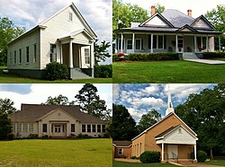
Mauk Post Office (ZIP code: 31058)
-
The Original Mauk School began as a one-room schoolhouse when it was built in 1909 and was located on the North side of Georgia Hwy 90. When the school pictured was opened to white children the original school was used by non white children until it was closed in the mid-1950s. This building was sold to Hinton Woodall who used it as a barn for several years. It was demolished several years later.The school pictured was built in the 1930s during the segregation era as a white only school and is located on Ga. Hwy. 127. The school was closed as a public school in 1956. In 1970, it was reopened as a private school and operated for a few years before the private school was disbanded. It was placed on the National Register of Historic Places on December 30, 2008.
References
- ^ "US Board on Geographic Names". United States Geological Survey. 2007-10-25. Retrieved 2008-01-31.
- ^ "Feature Detail Report for: Mauk". US Geological Survey. Retrieved 10 December 2010.


