
McClusky, North Dakota
McClusky, North Dakota | |
|---|---|
 Sign entering McClusky on Highway 200 westbound | |
 Location of McClusky, North Dakota | |
| Country | United States |
| State | North Dakota |
| County | Sheridan |
| Area | |
| • Total | 0.4 sq mi (1.0 km2) |
| • Land | 0.4 sq mi (1.0 km2) |
| • Water | 0.0 sq mi (0.0 km2) |
| Elevation | 1,923 ft (586 m) |
| Population (2000) | |
| • Total | 415 |
| • Density | 1,072.9/sq mi (414.3/km2) |
| Time zone | UTC-6 (Central (CST)) |
| • Summer (DST) | UTC-5 (CDT) |
| ZIP code | 58463 |
| Area code | 701 |
| FIPS code | 38-49020Template:GR |
| GNIS feature ID | 1030134Template:GR |
McClusky is a city in Sheridan County, North Dakota in the United States. It is the county seat of Sheridan CountyTemplate:GR. The population was 415 at the 2000 census. McClusky was founded in 1905.
It is the geographic center of North Dakota.
History
McClusky was founded mainly by German and Norwegian settlers in 1905. Even with chernozem soil, the low rainfall of 16.5 inches per year makes farming in the area hard. The principal crops are flax and wheat which were greatly aided in 1976 by the completion of the McClusky Canal just west of town which brings valuable irrigation water 74 miles from Lake Audubon (close to the Garrison Dam) to near the source of the Sheyenne River. Tourism today largely revolves around cyclists and pheasant hunters. The major festival is the Midsummer Fest which is held annually during the second weekend of July. The local newspaper, the McClusky Gazette, is published weekly and maintains an office on Main Street.
Transportation
The Red River Valley and Western Railroad ran to McClusky and further west until the 1970s. North Dakota Highway 200 which runs through downtown is popular with cross-country cyclists. There is also an airport for small planes, the McClusky Municipal Airport.
Geography
McClusky is located at 47°29′3″N 100°26′32″W / 47.48417°N 100.44222°WInvalid arguments have been passed to the {{#coordinates:}} function (47.484280, -100.442103)Template:GR.
According to the United States Census Bureau, the city has a total area of 0.4 square miles (1.0 km²), all of it land.
Demographics
As of the censusTemplate:GR of 2000, there were 415 people, 205 households, and 110 families residing in the city. The population density was 1,072.9 people per square mile (410.9/km²). There were 247 housing units at an average density of 638.6/sq mi (244.5/km²). The racial makeup of the city was 99.28% White and 0.72% Native American. Hispanic or Latino of any race were 0.48% of the population.
There were 205 households out of which 18.0% had children under the age of 18 living with them, 47.8% were married couples living together, 5.4% had a female householder with no husband present, and 45.9% were non-families. 43.4% of all households were made up of individuals and 27.3% had someone living alone who was 65 years of age or older. The average household size was 1.93 and the average family size was 2.64.
In the city the population was spread out with 16.9% under the age of 18, 4.1% from 18 to 24, 17.8% from 25 to 44, 24.6% from 45 to 64, and 36.6% who were 65 years of age or older. The median age was 56 years. For every 100 females there were 82.8 males. For every 100 females age 18 and over, there were 82.5 males.
The median income for a household in the city was $21,731, and the median income for a family was $32,344. Males had a median income of $26,094 versus $15,625 for females. The per capita income for the city was $14,874. About 12.4% of families and 21.5% of the population were below the poverty line, including 33.3% of those under age 18 and 22.9% of those age 65 or over.
References
External links
Municipalities and communities of Sheridan County, North Dakota, United States | ||
|---|---|---|
| Cities | 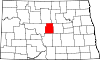 | |
| Townships | ||
| Unorganized territories | ||
| CDP | ||