McGinness Airport
Appearance
McGinness Airport | |||||||||||||||
|---|---|---|---|---|---|---|---|---|---|---|---|---|---|---|---|
| Summary | |||||||||||||||
| Airport type | Closed | ||||||||||||||
| Owner | Dorothy McGinness | ||||||||||||||
| Operator | Patrick McGinness | ||||||||||||||
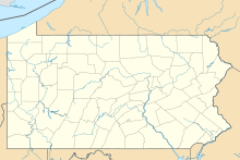
| Serves | Columbia, Pennsylvania | ||||||||||||||
| Elevation AMSL | 334 ft / 102 m | ||||||||||||||
| Coordinates | 40°01′31″N 076°29′14″W / 40.02528°N 76.48722°W | ||||||||||||||
| Map | |||||||||||||||
 | |||||||||||||||
| Runways | |||||||||||||||
| |||||||||||||||
| Statistics (2013) | |||||||||||||||
| |||||||||||||||
Source: SkyVector[1] | |||||||||||||||
McGinness Airport (FAA LID: 8N7) (also known as McGinness Field) is a closed public-use private airport located one mile from Columbia, Pennsylvania. It had been active from December 1949 till Spring 2014.[1]
In August 2021, the airport was bought by the Colombia Borough Council as a part of the boroughs ongoing economic revitalization efforts.[2]
References
[edit]- ^ a b "8N7: McGinness Airport". SkyVector. Archived from the original on 2015-02-22. Retrieved 2015-02-22.
- ^ "REVITALIZATION - Small Pennsylvania town buys former airport for $1,495,000 to revitalize their economy via nature, innovation & technology". REVITALIZATION. Retrieved 2023-06-19.
External links
[edit]- List of Pennsylvania airports at Pennsylvania DOT Bureau of Aviation
- Aerial image as of April 1999 from USGS The National Map
- FAA Terminal Procedures for 8N7, effective October 3, 2024
- Resources for this airport:
- FAA airport information for 8N7
- AirNav airport information for K8N7
- ASN accident history for 8N7
- FlightAware airport information and live flight tracker
- NOAA/NWS weather observations: current, past three days
- SkyVector aeronautical chart, Terminal Procedures

