
Mead, West Virginia
Mead, West Virginia | |
|---|---|
| Country | United States |
| State | West Virginia |
| County | Raleigh |
| Elevation | 1,768 ft (539 m) |
| Time zone | UTC-5 (Eastern (EST)) |
| • Summer (DST) | UTC-4 (EDT) |
| ZIP codes | 25877 |
| Area code(s) | 304 & 681 |
| GNIS feature ID | 1543037[1] |
Mead is an unincorporated community in Raleigh County, West Virginia, United States. Mead is located on County Route 33 and Stonecoal Creek 2.7 miles (4.3 km) east-northeast of Rhodell.[2] Mead had a post office, which closed on June 10, 1989.[3] It was also known as Vanwood.
The community was named after C. H. Mead, the proprietor of a local mine.[4]
Gallery
-
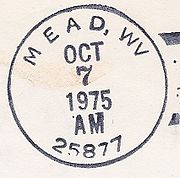 Mead postmark

References
- ^ "Mead". Geographic Names Information System. United States Geological Survey, United States Department of the Interior.
- ^ Raleigh County, West Virginia General Highway Map (PDF) (Map). West Virginia Department of Transportation. 2011. p. 3. Retrieved November 11, 2011.
{{cite map}}: Cite has empty unknown parameter:|trans_title=(help) - ^ "Postmaster Finder - Post Offices by ZIP Code". United States Postal Service. Retrieved November 11, 2011.
- ^ Kenny, Hamill (1945). West Virginia Place Names: Their Origin and Meaning, Including the Nomenclature of the Streams and Mountains. Piedmont, WV: The Place Name Press. p. 408.


This article about a location in Raleigh County, West Virginia is a stub. You can help Wikipedia by expanding it. |