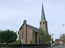
Meijel
Appearance
Meijel
Méél | |
|---|---|
Town and former municipality | |
 | |
 | |
| Country | Netherlands |
| Province | Limburg |
| Municipality | Peel en Maas |
| Time zone | UTC+1 (CET) |
| • Summer (DST) | UTC+2 (CEST) |
Meijel () (Template:Lang-li) is a former municipality and a town in southeastern Netherlands.
External links
Wikimedia Commons has media related to Meijel.


