Monte Moro Pass
Appearance
| Monte Moro Pass | |
|---|---|
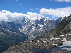
 View of Monte Rosa from the pass | |
| Elevation | 2,853 m (9,360 ft)[1] |
| Traversed by | Trail |
| Location | Valais, Switzerland Piedmont, Italy |
| Range | Pennine Alps |
| Coordinates | 45°59′53″N 7°58′53″E / 45.99806°N 7.98139°E |
The Monte Moro Pass (German: Monte Moropass, Italian: Passo del Monte Moro) is an Alpine pass located on the border between Switzerland and Italy. It connects Saas-Almagell in the Swiss canton of Valais to Macugnaga in the Italian region of Piedmont. The pass lies at the foot of Monte Moro.
Historically the Monte Moro is an important border crossing between the valleys of Saas and Macugnaga. It is traversed by a trail and is one of the highest passes on the Monte Rosa Tour.
References
External links
![]() Media related to Passo di Monte Moro at Wikimedia Commons
Media related to Passo di Monte Moro at Wikimedia Commons

