
Mount Zion, Georgia
- There are also other places named Mount Zion.
Mount Zion, Georgia | |
|---|---|
 Mount Zion City Hall | |
 Location in Carroll County and the state of Georgia | |
| Country | United States |
| State | Georgia |
| County | Carroll |
| Area | |
| • Total | 9.8 sq mi (25.5 km2) |
| • Land | 9.7 sq mi (25.1 km2) |
| • Water | 0.2 sq mi (0.4 km2) |
| Elevation | 1,201 ft (366 m) |
| Population (2010) | |
| • Total | 1,696 |
| • Density | 175/sq mi (67.5/km2) |
| Time zone | UTC-5 (Eastern (EST)) |
| • Summer (DST) | UTC-4 (EDT) |
| ZIP code | 30150 |
| Area code | 770 |
| FIPS code | 13-53620[1] |
| GNIS feature ID | 0332438[2] |
| Website | www |
Mount Zion is a city in Carroll County, Georgia, United States. The population was 1,696 at the 2010 census.[3]
Geography
Mount Zion is located in northern Carroll County at 33°37′52″N 85°10′48″W / 33.63111°N 85.18000°W (33.631113, -85.179868).[4] It is 8 miles (13 km) northwest of Carrollton, the county seat, and 5 miles (8 km) southwest of Interstate 20 in Bremen.
According to the United States Census Bureau, Mount Zion has a total area of 9.8 square miles (25.5 km2), of which 9.7 square miles (25.1 km2) is land and 0.15 square miles (0.4 km2), or 1.71%, is water.[3]
Demographics
| Census | Pop. | Note | %± |
|---|---|---|---|
| 1920 | 131 | — | |
| 1930 | 121 | −7.6% | |
| 1940 | 84 | −30.6% | |
| 1950 | 141 | 67.9% | |
| 1960 | 211 | 49.6% | |
| 1970 | 264 | 25.1% | |
| 1980 | 445 | 68.6% | |
| 1990 | 511 | 14.8% | |
| 2000 | 1,275 | 149.5% | |
| 2010 | 1,696 | 33.0% | |
| 2014 (est.) | 1,721 | [5] | 1.5% |
As of the census[1] of 2000, there were 1,275 people, 434 households, and 351 families residing in the city. The population density was 130.7 people per square mile (50.5/km²). There were 467 housing units at an average density of 47.9 per square mile (18.5/km²). The racial makeup of the city was 94.12% White, 3.76% African American, 0.24% Native American, 0.94% Asian, 0.24% from other races, and 0.71% from two or more races. Hispanic or Latino of any race were 0.31% of the population.
There were 434 households out of which 44.5% had children under the age of 18 living with them, 63.6% were married couples living together, 13.1% had a female householder with no husband present, and 18.9% were non-families. 15.7% of all households were made up of individuals and 6.5% had someone living alone who was 65 years of age or older. The average household size was 2.94 and the average family size was 3.27.
In the city the population was spread out with 31.3% under the age of 18, 8.2% from 18 to 24, 34.4% from 25 to 44, 19.3% from 45 to 64, and 6.8% who were 65 years of age or older. The median age was 31 years. For every 100 females there were 107.0 males. For every 100 females age 18 and over, there were 96.9 males.
The median income for a household in the city was $41,912, and the median income for a family was $43,438. Males had a median income of $31,959 versus $20,662 for females. The per capita income for the city was $16,080. About 11.8% of families and 12.9% of the population were below the poverty line, including 15.8% of those under age 18 and 22.6% of those age 65 or over.
Notable people
- Walter Terry Colquitt, Methodist preacher, United States Representative and Senator from Georgia
- James Mitchell, U.S. Commissioner of negro colonization for President Abraham Lincoln
References
- ^ a b "American FactFinder". United States Census Bureau. Retrieved 2008-01-31.
- ^ "US Board on Geographic Names". United States Geological Survey. 2007-10-25. Retrieved 2008-01-31.
- ^ a b "Geographic Identifiers: 2010 Demographic Profile Data (G001): Mount Zion city, Georgia". U.S. Census Bureau, American Factfinder. Retrieved July 18, 2014.
- ^ "US Gazetteer files: 2010, 2000, and 1990". United States Census Bureau. 2011-02-12. Retrieved 2011-04-23.
- ^ "Annual Estimates of the Resident Population for Incorporated Places: April 1, 2010 to July 1, 2014". Retrieved June 4, 2015.
- ^ "Census of Population and Housing". Census.gov. Retrieved June 4, 2015.
External links
Municipalities and communities of Carroll County, Georgia, United States | ||
|---|---|---|
| Cities | 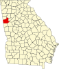 | |
| Towns | ||
| CDP | ||
| Other unincorporated communities | ||
| Ghost town | ||
| Footnotes | ‡This populated place also has portions in an adjacent county or counties | |