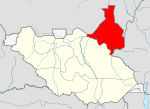
Nasir, South Sudan
Nasir
Warkai, Choghokak | |
|---|---|
| Country | |
| State | Upper Nile |
| County | Luakpiny/Nasir County |
| Time zone | UTC+3 (East Africa Time) |
Nasir is a small town in Upper Nile state, in the Greater Upper Nile region of northeastern South Sudan.[1]
The town is on the north side of the Sobat River, about 30 kilometres (19 mi) from the Ethiopian border. It is the administrative center of Luakpiny/Nasir County.
Early days
Charles W. Gwynn passed through this town while he was reconnoitering the Ethiopian-Sudan border in March 1900. There he found "a young Egyptian officer in charge of a small Government post, but he apparently had had no communications with anyone since the river Sobat had fallen, and was anxiously awaiting its rise in hopes of a steamer to replenish his stores."[2]

Civil war
SPLA-Nasir, a splinter faction of the Sudan People's Liberation Army active from 1991 to 1994, derived their name from the town because it was their base.[citation needed]
References
- ^ Maplandia world gazetteer
- ^ Gwynn, "The Frontiers of Abyssinia: A Retrospect", Journal of the Royal African Society, 36 (1937), p. 157

