From Wikipedia, the free encyclopedia
Location of Grant County in South Dakota This is a list of the National Register of Historic Places listings in Grant County, South Dakota .
This is intended to be a complete list of the properties and districts on the National Register of Historic Places in Grant County , South Dakota , United States . The locations of National Register properties and districts for which the latitude and longitude coordinates are included below, may be seen in a map.[ 1]
There are 15 properties and districts listed on the National Register in the county.
This National Park Service list is complete through NPS recent listings posted November 1, 2024. [ 2]
[ 3] Name on the Register[ 4]
Image
Date listed[ 5]
Location
City or town
Description
1
Big Stone City Hall Big Stone City Hall July 28, 2004 (#04000764 ) 469 Main 45°17′37″N 96°27′48″W / 45.293611°N 96.463333°W / 45.293611; -96.463333 (Big Stone City Hall ) Big Stone City
2
Brown Earth Presbyterian Church Brown Earth Presbyterian Church August 29, 1984 (#84003288 ) Northeast of Stockholm 45°07′20″N 96°46′20″W / 45.122156°N 96.772113°W / 45.122156; -96.772113 (Brown Earth Presbyterian Church ) Stockholm
3
First Congregational Church of Milbank First Congregational Church of Milbank April 19, 1978 (#78002553 ) E. 3rd Ave. 45°13′31″N 96°37′39″W / 45.225278°N 96.6275°W / 45.225278; -96.6275 (First Congregational Church of Milbank ) Milbank
4
First National Bank of Milbank First National Bank of Milbank April 19, 1978 (#78002554 ) 225 S. Main St. 45°13′13″N 96°38′10″W / 45.220278°N 96.636111°W / 45.220278; -96.636111 (First National Bank of Milbank ) Milbank
5
First State Bank Building First State Bank Building February 26, 1987 (#87000221 ) 2nd Ave and 4th St[ 6] 45°00′59″N 96°34′17″W / 45.016438°N 96.571482°W / 45.016438; -96.571482 (First State Bank Building ) Revillo
6
Herman Freiwald Barn Herman Freiwald Barn February 19, 2008 (#08000045 )[ 7] 48603 148th St. 45°14′20″N 96°28′23″W / 45.238952°N 96.473077°W / 45.238952; -96.473077 (Herman Freiwald Barn ) Big Stone City
7
James A. and Ida Bell Gold House James A. and Ida Bell Gold House February 19, 2008 (#08000046 ) 202 2nd Ave. 45°17′51″N 96°27′52″W / 45.2975°N 96.464444°W / 45.2975; -96.464444 (James A. and Ida Bell Gold House ) Big Stone City
8
Grant County Courthouse Grant County Courthouse February 10, 1993 (#92001858 ) Junction of Park Ave. and Main St. 45°13′03″N 96°38′08″W / 45.2175°N 96.635556°W / 45.2175; -96.635556 (Grant County Courthouse ) Milbank
9
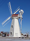
Hollands Grist Mill Hollands Grist Mill February 24, 1981 (#81000573 ) U.S. Route 12 45°13′21″N 96°37′07″W / 45.2225°N 96.618611°W / 45.2225; -96.618611 (Hollands Grist Mill ) Milbank
10
Emil and Hannah Johnson House Emil and Hannah Johnson House February 19, 2008 (#08000047 ) 117 Diggs Ave. 45°13′39″N 96°38′20″W / 45.2275°N 96.638889°W / 45.2275; -96.638889 (Emil and Hannah Johnson House ) Milbank
11
George and Mary Koch Farm George and Mary Koch Farm February 19, 2008 (#08000048 ) 14849 474th Ave. 45°13′48″N 96°43′18″W / 45.2299°N 96.7217°W / 45.2299; -96.7217 (George and Mary Koch Farm ) Twin Brooks
12
Lebanon Lutheran Church Lebanon Lutheran Church September 15, 1977 (#77001244 ) 146 St and 452 Ave[ 8] 45°16′02″N 97°09′52″W / 45.267249°N 97.164403°W / 45.267249; -97.164403 (Lebanon Lutheran Church ) Summit
13
Milbank Carnegie Library Milbank Carnegie Library November 21, 1978 (#78002555 ) S. 3rd Ave. 45°13′31″N 96°38′17″W / 45.225278°N 96.638056°W / 45.225278; -96.638056 (Milbank Carnegie Library ) Milbank
14
Ole Nelson Barn Ole Nelson Barn February 19, 2008 (#08000049 ) 14674 454th Ave. 45°15′30″N 97°07′20″W / 45.258433°N 97.122302°W / 45.258433; -97.122302 (Ole Nelson Barn ) Summit
15
Swedish Lutheran Church of Strandburg Swedish Lutheran Church of Strandburg February 17, 1978 (#78002556 ) 162 St and 472 Ave[ 9] 45°02′27″N 96°45′38″W / 45.040823°N 96.760493°W / 45.040823; -96.760493 (Swedish Lutheran Church of Strandburg ) Strandburg
^ The latitude and longitude information provided in this table was derived originally from the National Register Information System, which has been found to be fairly accurate for about 99% of listings. Some locations in this table may have been corrected to current GPS standards.
^ National Park Service, United States Department of the Interior , "National Register of Historic Places: Weekly List Actions" , retrieved November 1, 2024.
^ Numbers represent an alphabetical ordering by significant words. Various colorings, defined here , differentiate National Historic Landmarks and historic districts from other NRHP buildings, structures, sites or objects.
^ "National Register Information System" . National Register of Historic Places National Park Service . April 24, 2008.^ The eight-digit number below each date is the number assigned to each location in the National Register Information System database, which can be viewed by clicking the number.
^ See 2017 photo , including street sign
^ Listed on NRHP as "Herman Friewald Barn"; but name is spelled "Freiwald" throughout nominating form
^ See 2017 photo , including street sign
^ See 2017 photo , including street sign
Topics Lists by Other lists


