
Nemyryntsi
Nemirintsy
Немиринці | |
|---|---|
Village | |
| Coordinates: 49°37′12″N 29°3′0″E / 49.62000°N 29.05000°E | |
| Country | Ukraine |
| Oblast | Zhytomyr Oblast |
| Raion | Ruzhyn Raion |
| Area | |
| • Total | 3,026 km2 (1,168 sq mi) |
| Elevation | 251 m (823 ft) |
| Population | |
| • Total | 772 |
| • Density | 255.12/km2 (660.8/sq mi) |
| Time zone | UTC-6 |
| Area code | 4138 |
Nemirintsy (Ukrainian: Немиринці; Russian: Немиринцы) is a village in Ruzhyn Raion, Zhytomyr Oblast (province) of Ukraine on Drevlyans historic lands. It has a population of 772 people.
History
1556 founded village Nemirintsy.
1556-1569 part of Grand Duchy of Lithuania
1569-1793 part of Polish-Lithuanian Commonwealth, Kiev Voivodeship
1793-1846 part of Russian Empire, Kiev Guberniya
1846-1917 part of Russian Empire, Kiev Guberniya, Berdychiv Uyezd.
1917-1919 part of Ukrainian People's Republic, Ukrainian People's Republic, Hetmanate, Ukrainian People's Republic.
1919-1923 part of USSR, Kiev Guberniya, Berdychiv Uyezd.
1923-1937 part of USSR, Kiev Guberniya, Berdychiv Okrug.
1930-1937 part of USSR, Kiev Oblast, Ruzhyn Raion.
22.09.1937-1931 part of USSR, Zhytomyr Oblast, Ruzhyn Raion.
1991- part of Ukraine, Zhytomyr Oblast, Ruzhyn Raion.
Common local names
Grabchak, Nikitenko, Markitan, Dzubenko, Davydchuk, Khodakivskyi, Possessor(Renter, Lessee, Tenant, Possessor), Yastrubenko, Pylyponchik, Rozhkovskyi, Rozhkivskyi,Zaiats,Krasnitskyi
Famous people
Images
-
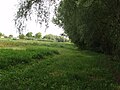
 Nemirintsy01
 -
 Nemirintsy02-02
 -
 Nemirintsy03-02
 -
 Nemirintsy04-02
 -
 Nemirintsy05-02
 -
 Nemirintsy06-02
 -
 Nemirintsy07-02
 -
 Nemirintsy08-02
 -
 Nemirintsy09
 -
 Nemirintsy010
 -
 Nemirintsy011
 -
 Nemirintsy012
 -
 Nemirintsy013
 -
 Nemirintsy014
 -
 Nemirintsy015
 -
 Nemirintsy016
 -
 Nemirintsy017
 -
 Nemirintsy018
 -
 Nemirintsy019
 -
 Nemirintsy020
 -
 Nemirintsy021
 -
 Nemirintsy022
 -
 Nemirintsy023
 -
 Nemirintsy024
 -
 Nemirintsy025
 -
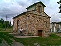 Nemirintsy-Old store
 -
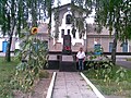 Nemirintsy-WW2 memorial


Nearby villages
- Ruzhyn (Ружын)
- Bilylivka (Белиловка)
- Koziatyn (Казатин)
- Berdychev (Бердичев)
- Skvira (Сквира)
- Pohrebysche (Погребище)
- Bila Tserkva (Белая Церковь)
See also
External links
This article about a location in Zhytomyr Oblast is a stub. You can help Wikipedia by expanding it. |