
New Town, Georgia
New Town, Georgia | |
|---|---|
 New Town  New Town | |
| Coordinates: 34°31′50″N 84°54′21″W / 34.53056°N 84.90583°W | |
| Country | United States |
| State | Georgia |
| County | Gordon |
| Elevation | 669 ft (204 m) |
| Time zone | UTC-5 (Eastern (EST)) |
| • Summer (DST) | UTC-4 (EDT) |
| Area code(s) | 706/762 |
| GNIS feature ID | 332494[1] |
New Town is an unincorporated community in Gordon County, Georgia, United States, located northeast of Calhoun. New Town is near the New Echota historic site, which was formerly part of the Cherokee Nation. Ashworth Middle School and Gordon Central High School are located in the New Town community.
New Town is the English translation of the Indian name.[2]
Geography
Alan Creek is a small stream located in New Town. It is a tributary of the Oostanaula River, part of the Coosa-Alabama-Mobile River watershed and is located near the New Echota Historic Site.
References
- ^ "US Board on Geographic Names". United States Geological Survey. 2007-10-25. Retrieved 2008-01-31.
- ^ "Gordon County (see following page from that which loads)". Calhoun Times. 1 September 2004. p. 87. Retrieved 26 April 2015.
Municipalities and communities of Gordon County, Georgia, United States | ||
|---|---|---|
| Cities | 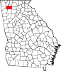 | |
| Town | ||
| Unincorporated communities | ||
This Georgia (U.S. state) location article is a stub. You can help Wikipedia by expanding it. |