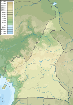
Nganha
Appearance
Ngan-ha | |
|---|---|
Village | |
| Coordinates: 7°26′09″N 13°55′36″E / 7.435856°N 13.926736°E | |
| Country | |
| Region | Adamawa |
| Time zone | UTC+1 (WAT) |
Nganha is a commune in Cameroon. It has a population between 3,000 and 5,000. It is about 10 kilometres (6.2 mi) northwest of the summit of Tchabal Nganha, a large stratovolcano on the Ngaoundere Plateau, a highland area in the Adamawa Region of Cameroon.
See also
References
- Site de la primature - Élections municipales 2002 Template:Fr icon
- Contrôle de gestion et performance des services publics communaux des villes camerounaises - Thèse de Donation Avele, Université Montesquieu Bordeaux IV Template:Fr icon
- Charles Nanga, La réforme de l’administration territoriale au Cameroun à la lumière de la loi constitutionnelle n° 96/06 du 18 janvier 1996, Mémoire ENA. Template:Fr icon

