
Oasis, New Mexico
Oasis, New Mexico | |
|---|---|
Census-designated place | |
| Country | United States |
| State | New Mexico |
| County | Sierra |
| Area | |
| • Total | 2.090 sq mi (5.41 km2) |
| • Land | 2.090 sq mi (5.41 km2) |
| • Water | 0 sq mi (0 km2) |
| Elevation | 4,258 ft (1,298 m) |
| Population | |
| • Total | 149 |
| • Density | 71/sq mi (28/km2) |
| Time zone | UTC-7 (Mountain (MST)) |
| • Summer (DST) | UTC-6 (MDT) |
| Area code | 575 |
| GNIS feature ID | 898828[2] |
Oasis is a census-designated place in Sierra County, New Mexico, United States. Its population was 149 as of the 2010 census.[1]
Geography
Oasis is located at 32°55′40″N 107°18′59″W / 32.927701°N 107.316417°W. According to the U.S. Census Bureau, the community has an area of 2.090 square miles (5.41 km2), all of it land.[1]
While Interstate 25 passes through the community, it does not have an exit; the community is about halfway between exits 59 and 63. New Mexico State Road 187 also passes through the community. Caballo Lake is located to the east of the community.
References
- ^ a b c d "2010 Census Gazetteer Files - Places: New Mexico". U.S. Census Bureau. Retrieved August 21, 2014.
{{cite web}}: Unknown parameter|deadurl=ignored (|url-status=suggested) (help) - ^ "Oasis". Geographic Names Information System. United States Geological Survey, United States Department of the Interior.
Municipalities and communities of Sierra County, New Mexico, United States | ||
|---|---|---|
| Cities | 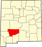 | |
| Villages | ||
| CDPs | ||
| Other communities | ||
| Ghost towns | ||
This New Mexico state location article is a stub. You can help Wikipedia by expanding it. |