
Overasselt
Overasselt | |
|---|---|
 St. Antonius Abtkerk | |
 Coat of arms | |
| Coordinates: 51°45′35″N 5°47′15″E / 51.75972°N 5.78750°E | |
| Country | Netherlands |
| Province | Gelderland |
| Municipality | Heumen |
| Area | |
| • Total | 20.25 km2 (7.82 sq mi) |
| Population (2007) | 3,330 |
Overasselt is a village in the Dutch province of Gelderland. It is located in the municipality of Heumen.
Overasselt was a separate municipality until 1 July 1980, when it was merged with Heumen. Overasselt has a population of about 2500. [1] The current mayor of Overasselt is Mr de Grunt.
References
- ^ Ad van der Meer and Onno Boonstra, Repertorium van Nederlandse gemeenten, KNAW, 2011.
External links
- Template:Kuyper Map of the former municipality, around 1868.
51°46′N 5°48′E / 51.767°N 5.800°E
Gallery
-
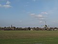 Overasselt, view to the village
 -
 Overasselt, church: Sint Antonius Abtkerk
 -
 Overasselt, windmill: molen Zeldenrust


This Gelderland location article is a stub. You can help Wikipedia by expanding it. |