
Owens Wells, Mississippi
Owens Wells, Mississippi | |
|---|---|
 | |
 Owens Wells  Owens Wells | |
| Coordinates: 33°05′42″N 89°58′04″W / 33.09500°N 89.96778°W | |
| Country | United States |
| State | Mississippi |
| County | Holmes |
| Elevation | 292 ft (89 m) |
| Time zone | UTC-6 (Central (CST)) |
| • Summer (DST) | UTC-5 (CDT) |
| ZIP code | 39095 |
| Area code | 662 |
| GNIS feature ID | 675353[1] |
Owens Wells is an unincorporated community in Holmes County, Mississippi, United States. Owens Wells is located near Mississippi Highway 12 and is approximately 6 miles (9.7 km) east of Lexington and approximately 8 miles (13 km) west of Durant.
References
Municipalities and communities of Holmes County, Mississippi, United States | ||
|---|---|---|
| Cities | 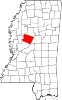 | |
| Towns | ||
| Unincorporated communities | ||
| Ghost town | ||
This Mississippi location article is a stub. You can help Wikipedia by expanding it. |