Para Creek
| Para Creek Para River | |
|---|---|
 Painting of the Para Creek near plantation Berseba (~1860) | |
| Native name | Parakreek (Dutch) |
| Location | |
| Country | Suriname |
| District | Wanica & Para District |
| Physical characteristics | |
| Source | |
| • coordinates | 5°24′05″N 55°09′45″W / 5.4015°N 55.1624°W |
| Mouth | Suriname River |
• coordinates | 5°44′47″N 55°07′40″W / 5.74642°N 55.12789°W |
| Length | 77.65 kilometres (48.25 mi)[1] |
| Basin features | |
| Progression | Suriname River→Atlantic Ocean |
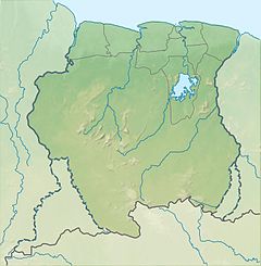
Para Creek (Dutch: Parakreek also Para River) is a blackwater creek in the Wanica & Para District of Suriname.[2] It is a tributary of the Suriname River, and was home to many plantations. The area around the creek has been cultivated since the English period.[3] The Para District has been named after the creek in 1966.[4]
Overview
[edit]The Para Creek is fed by many small creeks from the savanna area, and has a drainage basin of 1,650 square kilometres (640 sq mi).[5] During the colonisation of Suriname, most plantations were built along the Suriname River and the Para Creek, because the ground was fertile, and no additional infrastructure was required.[5] In the 20th century, many holiday resorts were built on the Para Creek and its tributaries.[6]
The northern part of Para Creek near the mouth experiences minor tidal movements, but has no salinity.[2] The southern part of the creek used to be home to many wood plantations.[7] The last 25 kilometres (16 mi) of the Para Creek are parallel to the Suriname River,[1] therefore, the Paradoorsnede, an artificial canal, was dug in the 18th century to provide better access.[7] The canal is 3.4 kilometres (2.1 mi) long.[1]
Fort Para
[edit]In 1685, Fort Para was constructed on the Para Creek near Houttuin to protect the plantations against attacks by the Amerindians, however in 1686 a peace treaty was signed between the tribes and Governor van Aerssen van Sommelsdijck.[8] In 1740, the fort was demolished.[9]
See also
[edit]References
[edit]- ^ a b c Planbureau 2014, p. 22.
- ^ a b "Flora en Fauna". Wianofru (in Dutch). Retrieved 7 May 2021.
- ^ "Parakreek". Suriname Plantages (in Dutch). Retrieved 7 May 2021.
- ^ Planbureau 2014, p. 1.
- ^ a b Planbureau 2014, p. 11.
- ^ Planbureau 2014, p. 17.
- ^ a b "Herstel regiem van de Pararivier". Star Nieuws (in Dutch). Retrieved 7 May 2021.
- ^ "Geschiedenis & achtergrond". Houttuyn (in Dutch). Retrieved 7 May 2021.
- ^ "Forten en verdedigingswerken". Suriname.nu (in Dutch). Retrieved 7 May 2021.
Bibliography
[edit]- Planbureau (2014). "Waterbeheersingsplan Pararivier en Zijkreken" (PDF). Planning Office Suriname (in Dutch).

