
Parkland, Oklahoma
Parkland, Oklahoma | |
|---|---|
 Parkland, Oklahoma Location within the state of Oklahoma | |
| Coordinates: 35°53′39″N 96°52′15″W / 35.89417°N 96.87083°W | |
| Country | United States |
| State | Oklahoma |
| County | Lincoln |
| Elevation | 1,030 ft (314 m) |
| Time zone | UTC-6 (Central (CST)) |
| • Summer (DST) | UTC-5 (CDT) |
| Area code(s) | 539/918 |
| FIPS code | 40-00700[1] |
| GNIS feature ID | 1102837[2] |
Parkland is a ghost town in northern Lincoln County, Oklahoma, United States. It is 4 miles (6 km) south of Agra, Oklahoma. Its name was adopted "to describe the character of the townsite".[3] It still exists as a small community.
History
The land where Parkland is located was opened to white settlement by the Land Run of 1891 on 28 September of that year. The Parkland Post Office was established some three years later, on 19 December 1894, with McShelly Fishback as the first postmaster.[4] The Parkland Post Office was closed on 15 June 1918.[3]
A tornado on 30 May 1897 demolished several houses of the town, killing two and wounding several.[5]
Free lots in the town of Kendrick, Oklahoma were offered to business owners in Parkland if they would move when Kendrick was platted in 1902.[6]
Chandler, Oklahoma and Stroud, Oklahoma were nearby railroad points. The Parkland Telephone company was organized and built telephone lines from Chandler to Stroud, linking them with Parkland and Cushing, Oklahoma. Later these lines were purchased by the Arkansas Valley Telephone Company.[7]
Parkland Cemetery is located approximately one mile (1.6 km) north of the community, at 35°51'15N 96°50'31"W.
References
- ^ "American FactFinder". United States Census Bureau. Archived from the original on September 11, 2013. Retrieved 2008-01-31.
{{cite web}}: Unknown parameter|deadurl=ignored (|url-status=suggested) (help) - ^ "US Board on Geographic Names". United States Geological Survey. 2007-10-25. Retrieved 2008-01-31.
- ^ a b Shirk, George (1987). Oklahoma Place Names. Norman, Oklahoma: University of Oklahoma Press. p. 268. ISBN 9780806120287.
- ^ Shirk, George. "First Post Offices within the Boundaries of Oklahoma" (PDF). Chronicles of Oklahoma. Retrieved 25 July 2009.
- ^ "Parkland, Oklahoma is Destroyed and Citizens are Injured" (PDF). New York Times. New York City, New York. 1 April 1897. Retrieved 25 July 2009.
- ^ Wilson, Linda. "Kendrick". Encyclopedia of Oklahoma History & Culture. Oklahoma Historical Society. Archived from the original on 20 July 2010. Retrieved 25 July 2009.
{{cite web}}: Unknown parameter|deadurl=ignored (|url-status=suggested) (help) - ^ Noble, John (June 1927). "Early Telephone History in Oklahoma". Chronicles of Oklahoma. 5 (2). Retrieved 25 July 2009.
External links
- Image of Old Parkland Store
- Oklahoma Digital Maps: Digital Collections of Oklahoma and Indian Territory
Municipalities and communities of Lincoln County, Oklahoma, United States | ||
|---|---|---|
| Cities | 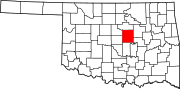 | |
| Towns | ||
| Unincorporated communities | ||
| Ghost towns | ||
| Footnotes | ‡This populated place also has portions in an adjacent county or counties | |