
Pep, New Mexico
Pep[1] is a small unincorporated community in southern Roosevelt County, in the southeastern part of the U.S. state of New Mexico. The community is composed almost entirely of farms and cattle ranches and is located about 7 miles south of Dora on New Mexico State Route 206.
References
Municipalities and communities of Roosevelt County, New Mexico, United States | ||
|---|---|---|
| City | 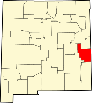 | |
| Town | ||
| Villages | ||
| Unincorporated communities | ||
| Ghost towns | ||
33°50′10″N 103°20′7″W / 33.83611°N 103.33528°W
This New Mexico state location article is a stub. You can help Wikipedia by expanding it. |