Pickshin, West Virginia
Appearance
Pickshin, West Virginia | |
|---|---|
Unincorporated community | |
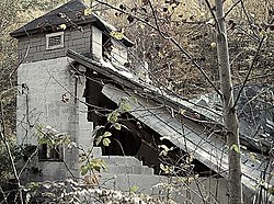
 Church at Pickshin West Virginia | |
| Coordinates: 37°38′30″N 81°13′41″W / 37.64167°N 81.22806°W | |
| Country | United States |
| State | West Virginia |
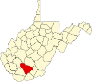
| County | Raleigh |
| Elevation | 1,991 ft (607 m) |
| Time zone | UTC-5 (Eastern (EST)) |
| • Summer (DST) | UTC-4 (EDT) |
| Area code(s) | 304 & 681 |
| GNIS feature ID | 1544803[1] |
Pickshin was an unincorporated community and coal town in Raleigh County, West Virginia, United States. Pickshin is 5 miles (8.0 km) south-southeast of Sophia. There are no inhabitants. During the years of 1917-27, it was documented to have mined 785,054 tons of coal.[2]
References
- ^ "US Board on Geographic Names". United States Geological Survey. 2007-10-25. Retrieved 2008-01-31.
- ^ http://www.wvminesafety.org/hist_tonnage.htm


