Pleiße
Appearance
| Pleiße | |
|---|---|
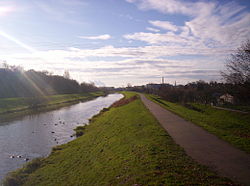
 The Pleiße in Markkleeberg, near Leipzig | |
 | |
| Location | |
| Location | Saxony, Thuringia, |
| Physical characteristics | |
| Source | |
| • location | Drei-Linden-Brunnen (formerly Alboldsbrunnen) in Ebersbrunn near Zwickau |
| • coordinates | 50°38′51″N 12°25′31″E / 50.64750°N 12.42528°E |
| • elevation | 443 m |
| Mouth | |
• location | White Elster (Elster flood plain) in Leipzig |
• coordinates | 51°19′21″N 12°21′27″E / 51.32250°N 12.35750°E |
• elevation | 103 m |
| Length | 90 km |
| Basin size | 1,876 km² |
| Basin features | |
| Progression | White Elster→ Saale→ Elbe→ North Sea |
| Landmarks |
|
| Tributaries | |
| • left | Koberbach, Sprotte |
| • right | Paradiesbach, Wyhra, Gösel |
| Inland ports | none |
| Navigable | no |
The Pleiße is a right tributary of the White Elster in Saxony, Germany. It has its source southwest of Zwickau at Ebersbrunn, then flows through Werdau, Crimmitschau, Altenburg, and other towns and villages in Saxony and Thuringia, before meeting the White Elster in Leipzig.
The river originally had a natural length of 115 km; however, south of Leipzig, it has been straightened, which shortened it to around 90 km.
See also
Notes
- The information in this article is based on and/or translated from its German equivalent.
External links
- Schumann, August (1821). "Die Pleiße". Vollständiges Staats-, Post- und Zeitungslexikon von Sachsen (in German). Vol. 8. Zwickau. p. 396.
