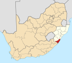
Port Shepstone
Template:Infobox South African town 2011 Port Shepstone is situated on the mouth of the largest river on the south coast of KwaZulu-Natal, South Africa, the Mzimkulu River (the great home of all rivers). 120 kilometres (75 mi) south of Durban, it is the administrative, educational and commercial centre for southern Natal.
History
Port Shepstone was founded in 1867 when marble was discovered nearby and is named after Sir Theophilus Shepstone of the Natal government of the 1880s. William Bazley built a harbour and the first coaster entered the harbour on the May 8, 1880. In 1882 a party of 246 Norwegian immigrants settled here and played a large part in the development of the area. After the opening of the railway to Durban in 1901 the harbour fell in disuse and eventually the river silted up again making it impossible to use. The 27,000 candela lighthouse still stands at the mouth of the Mzimkulu River.
Industries and agriculture
Its industries include a sugar mill, a lime works and a marble quarry. Timber, wattle bark and sub-tropical fruit are produced in the district.
Transport
Port Shepstone railway station opened in 1917, serving as both the southern terminus of the Cape gauge line from & to Durban, as well as the southern coastal terminus of the narrow gauge Alfred County Railway to Harding.
After the standard gauge Transnet passenger services shut down in 1986, the ACR continued operations until 2005, when the famous Banana Express ceased operation.[1]
Education
The first school was opened in 1883 but by 1950 the school became too small. The Port Shepstone School split into two, the Port Shepstone Primary School and the Port Shepstone High School. There is also the Port Shepstone Secondary School
Twin towns – Sister cities
Port Shepstone is twinned with:
 Oskarshamn, Sweden[2]
Climate
| Climate data for Port Shepstone | |||||||||||||
|---|---|---|---|---|---|---|---|---|---|---|---|---|---|
| Month | Jan | Feb | Mar | Apr | May | Jun | Jul | Aug | Sep | Oct | Nov | Dec | Year |
| Mean daily maximum °C (°F) | 26 (79) |
26 (79) |
25 (77) |
24 (75) |
23 (73) |
21 (70) |
21 (70) |
21 (70) |
21 (70) |
22 (72) |
23 (73) |
25 (77) |
23 (73) |
| Daily mean °C (°F) | 23 (73) |
23 (73) |
23 (73) |
21 (70) |
19 (66) |
17 (63) |
16 (61) |
17 (63) |
18 (64) |
19 (66) |
20 (68) |
22 (72) |
19 (66) |
| Mean daily minimum °C (°F) | 20 (68) |
20 (68) |
20 (68) |
17 (63) |
15 (59) |
12 (54) |
12 (54) |
13 (55) |
15 (59) |
16 (61) |
18 (64) |
19 (66) |
16 (61) |
| Average precipitation mm (inches) | 121 (4.8) |
126 (5.0) |
148 (5.8) |
82 (3.2) |
60 (2.4) |
31 (1.2) |
38 (1.5) |
49 (1.9) |
87 (3.4) |
114 (4.5) |
123 (4.8) |
127 (5.0) |
1,106 (43.5) |
| Source: Weatherbase [3] | |||||||||||||
References
- ^ "KNOCKING LINES OFF THE MAP". railwaysafrica.com. 2009-02-27. Retrieved 2009-07-10.
- ^ Lindquist, Ted. "Internationella frågor och vänorter". Oskarshamn Municipality (in Swedish). Retrieved 2013-07-25.
- ^ "Climate Statistics for Port Shepstone, Kwazulu-Natal, South Africa". Retrieved May 8, 2012.

