Psefir
Appearance
| Psefir | |
|---|---|
| Physical characteristics | |
| Mouth | Fars |
• coordinates | 44°36′17″N 40°28′31″E / 44.60472°N 40.47528°E |
| Length | 67 km (42 mi) |
| Basin size | 378 km2 (146 sq mi) |
| Basin features | |
| Progression | Fars→ Laba→ Kuban→ Sea of Azov |
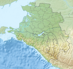
The Psefir (Russian: Псефирь) is a river in Krasnodar Krai, Russia, which flows into the Fars. It is 67 kilometres (42 mi) long, and has a drainage basin of 378 square kilometres (146 sq mi).[1] The area around the river is populated by various Abadzekh and Circassian tribes. The stanitsa of Kostromskaya stands on the river.
References
[edit]- ^ "Река Псефирь (Псефир) in the State Water Register of Russia". textual.ru (in Russian).


