Quothquan
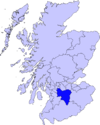
Quothquan (also formerly spelled Couth-Boan) (Gaelic: A’ Choitcheann, pronounced [ə xɔʰtʲçən̪ˠ]) is a village in Libberton parish, South Lanarkshire, Scotland.[1] It is located at NS994395, 3 km north-west of Biggar, and 6 km south-east of Lanark. To the south-west is the 335m high Quothquan Law, topped by the remains of a hill fort.[2]
The name is derived from Gaelic and translates as The Common.
References
- ^ "A Topographical Dictionary of Scotland (1846), pp. 396-399". Retrieved 2008-01-13.
- ^ "Quothquan Law, NMRS number NS93NE 11". RCAHMS. Retrieved 2008-01-15.
Wikimedia Commons has media related to Quothquan.
55°38′19″N 3°35′59″W / 55.63861°N 3.59972°W

