Robbins Airport (Wyoming)
Appearance
Robbins Airport | |||||||||||||||
|---|---|---|---|---|---|---|---|---|---|---|---|---|---|---|---|
| Summary | |||||||||||||||
| Airport type | Private | ||||||||||||||
| Owner/Operator | Dale Robbins | ||||||||||||||
| Serves | Medicine Bow | ||||||||||||||
| Location | Medicine Bow, Wyoming, United States of America | ||||||||||||||
| Opened | February 1971 | ||||||||||||||
| Time zone | Mountain Standard Time (UTC−07:00) | ||||||||||||||
| • Summer (DST) | Mountain Daylight Time (UTC−06:00) | ||||||||||||||
| Elevation AMSL | 2,207 m / 7,240 ft | ||||||||||||||
| Coordinates | 42°15′34.5″N 105°51′30.7″W / 42.259583°N 105.858528°W | ||||||||||||||
| Map | |||||||||||||||
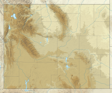
Airport location in Wyoming, United States. | |||||||||||||||
 | |||||||||||||||
| Runways | |||||||||||||||
| |||||||||||||||
| Statistics (2019) | |||||||||||||||
| |||||||||||||||
Robbins Airport is a small private airfield north of Medicine Bow, Wyoming. It is owned and operated by Dale Robbins.[1]
References
[edit]- ^ a b "Robbing Airport SkyVector". SkyVector. SkyVector Aeronautical Charts. Retrieved 9 May 2019.
External links
[edit]

