Rolling River First Nation
Appearance
(Redirected from Rolling River 67)
| Treaty | Treaty 4 |
|---|---|
| Headquarters | Erickson, Manitoba |
| Land[1] | |
| Main reserve | Rolling River 67 |
| Other reserve(s) |
|
| Population (2021)[1] | |
| On reserve | 348 |
| On other land | 5 |
| Off reserve | 765 |
| Total population | 1118 |
| Tribal Council[1] | |
| West Region Tribal Council | |
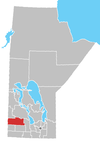
The Rolling River First Nation (Ojibwe: Ditibineya-ziibiing)[2] is an Ojibwe First Nations community in Manitoba, located south of Riding Mountain National Park.[3]
About half of the members are resident on its reserves, which are located south and east of Erickson, Manitoba.
Reserve lands
[edit]Rolling River First Nation is in possession of three reserves:[4]
- Rolling River 67 (50°27′28″N 99°59′32″W / 50.45778°N 99.99222°W) — the main reserve, with a total size of 6,776.10 ha (16,744.1 acres). It is located 64 km (40 mi) north of Brandon. Bordered mostly by the RM of Harrison, it also has a significant border with the RM of Clanwilliam, as well as a much smaller border with the RM of Minto.
- Rolling River 67A (50°38′27″N 99°51′27″W / 50.64083°N 99.85750°W) — has a total size of 1,017.60 ha (2,514.5 acres)
- Rolling River 67B (50°27′55″N 99°54′48″W / 50.46528°N 99.91333°W) — has a total size of 297.10 ha (734.2 acres)
- Rolling River 67C (49°53′10″N 97°20′40″W / 49.88611°N 97.34444°W) — has a total size of 31.40 ha (77.6 acres)
- Treaty Four Reserve Grounds 77 — a reserve shared with several other First Nations; it has a total size of 99.20 ha (245.1 acres)
External links
[edit]References
[edit]- ^ "Home". Crown–Indigenous Relations and Northern Affairs Canada. Government of Canada. 3 November 2008.
- ^ Andy Thomas Thomas, Florence Paynter. The Significance of Creating First Nation Traditional Names Maps. Manitoba First Nations Education Resource Centre Inc. https://mfnerc.org/wp-content/uploads/2015/05/The-Significance-of-Creating-First-Nation-Traditional-Names-Maps.pdf
- ^ Parks Canada Agency, Government of Canada (2020-04-30). "Rolling River - Riding Mountain National Park". www.pc.gc.ca. Retrieved 2021-08-18.
- ^ Indigenous and Northern Affairs Canada (2019-04-09). "Rolling River | Reserves/Settlements/Villages". Crown–Indigenous Relations and Northern Affairs Canada. Government of Canada. Retrieved 2021-08-18.
50°27′41″N 99°59′56″W / 50.46139°N 99.99889°W

