Rott (Inn, Neuhaus am Inn)
| Rott | |
|---|---|
 | |
| Physical characteristics | |
| Mouth | Inn 48°27′12″N 13°25′32″E / 48.45333°N 13.42556°E |
| Length | 109 km |
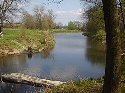
The Rott is a 109 km long river in Bavaria, Germany, left tributary of the Inn. Its source is in the municipality Wurmsham in Lower Bavaria, between Landshut and Waldkraiburg. It flows east through a rural area with small towns, including Neumarkt-Sankt Veit, Eggenfelden, Pfarrkirchen and Pocking. It flows into the Inn opposite Schärding, on the border with Austria.

