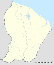
Saint-Laurent-du-Maroni Airport
Appearance
Saint-Laurent-du-Maroni Airport | |||||||||||
|---|---|---|---|---|---|---|---|---|---|---|---|
| Summary | |||||||||||
| Operator | Conseil général de la Guyane | ||||||||||
| Serves | Saint-Laurent-du-Maroni, French Guiana | ||||||||||
| Elevation AMSL | 17 ft / 5 m | ||||||||||
| Coordinates | 05°29′00″N 54°02′04″W / 5.48333°N 54.03444°W | ||||||||||
| Map | |||||||||||
 | |||||||||||
| Runways | |||||||||||
| |||||||||||
Saint-Laurent-du-Maroni Airport (IATA: LDX, ICAO: SOOM) is an airport serving Saint-Laurent-du-Maroni, a commune of French Guiana. The city is on the Maroni River, the border with Suriname.
The St Laurent Du Maroni non-directional beacon (Ident: CW) is located 0.9 nautical miles (1.7 km) south of the field.[3]
Airlines and destinations
| Airlines | Destinations |
|---|---|
| Air Guyane Express | Cayenne, Grand Santi, Maripasoula, Paramaribo,[4] Saul |
See also
References
- ^ Airport information for Saint-Laurent at Great Circle Mapper.
- ^ Google Maps - St Laurent
- ^ St Laurent Du Maroni NDB
- ^ "Air Guyane Express". Retrieved 25 November 2013.
External links
- OpenStreetMap - Saint-Laurent-du-Maroni
- OurAirports - Saint-Laurent-du-Maroni Airport
- SkyVector - Saint-Laurent-du-Maroni Airport
- Accident history for Saint-Laurent-du-Maroni Airport at Aviation Safety Network

